When you look at a Maxar satellite image, you are used to seeing one like what is shown above: the image is sharp and not fuzzy, the colors are perfectly balanced and it’s easy to understand what’s in the image. A lot of work goes into making that satellite image look the way it does.
It’s important that Maxar’s satellite imagery accurately depict what the Earth looks like, but it’s also a very powerful tool for science. Scientists leverage remote sensing (the use of satellite data to answer scientific questions) to assess climate change, observe the health of crops or monitor the devastation of a wildfire–to name a few examples–and all of this work relies on a well-calibrated set of satellite images.
Calibration is the process of tweaking the camera settings on the satellite so it captures the type of images that people are accustomed to receiving from Maxar. The company uses several types of calibration to make its WorldView commercial imagery the best in the world.
What is absolute radiometric calibration and why does it matter?
We lead the absolute radiometric calibration efforts, and our job is to make sure Maxar’s satellites in space are capturing the radiance from the Earth correctly. Radiance is the intensity of light energy from the Sun that reflects off the Earth and travels through the atmosphere to the cameras in our satellites. In other words, absolute radiometric calibration ensures the colors and their intensities are correct in the satellite image. Each color has its own corresponding spectral band such as blue, green and red. The satellites even collect some colors that we cannot see with the human eye, like near-infrared and shortwave infrared.
It’s very important that we make sure the radiance, or color intensity, is captured correctly because many users rely on that information:
- Scientists studying climate change need to know that forests are showing up as the right color to accurately reflect their health;
- Farmers use this data to determine whether or not a crop field is being watered properly or to look for pest infestation;
- Insurance companies leverage this information to determine the material make-up of rooftops;
- And the mining industry finds new locations for the extraction and exploitation of raw materials.

Maxar’s calibration efforts are considered world-class. When scientists compare our commercial industry results with NASA, the undisputed world leader in calibration, Maxar performs at the same level; that’s an uncommon feat in the commercial satellite imagery industry. When comparing imagery of the same location with comparable NASA Landsat 8-band imagery, Maxar imagery provides the same radiance within a small error. There are internationally agreed-upon locations for calibrating satellites, such as the site in Railroad Valley, Nevada. When imaging this location, Maxar satellites are within 5 percent of expected values for radiance measurements for Earth imaging sensors.
Other standard calibration imaging targets include remote locations like Australia and the Saharan Desert. By collecting data at these sites, we make sure Maxar’s satellites work correctly in different parts of the world. This allows Maxar to produce world-class satellite imagery, which enables our customers to gain actionable insight into what’s happening on Earth.
How does Maxar complete absolute radiometric calibration?
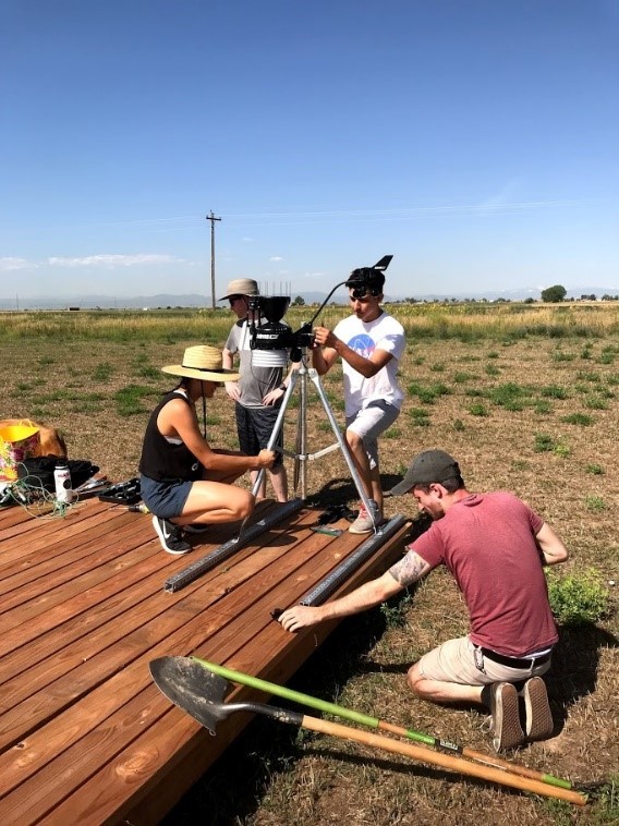
We collect on-the-ground measurements for radiance at the same time and place that the satellites collect an image so we can compare the results. This allows us to verify that the color intensities that the satellite is seeing in space are true to what is being reflected off the Earth. Most of the work happens at Maxar’s calibration facility in Ft. Lupton, Colorado. Tina Ochoa and I, as well as our student interns from the NASA Space Grant program at the University of Colorado-Boulder, primarily collect scientific measurements from early spring through early autumn at this calibration facility, which includes a three-acre field where we use specialized tools to measure calibration data while collecting satellite imagery at the same time.

This equipment and concurrent data include:
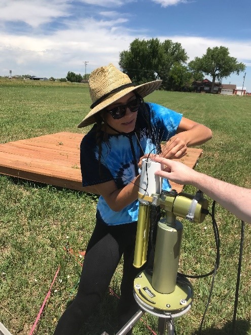
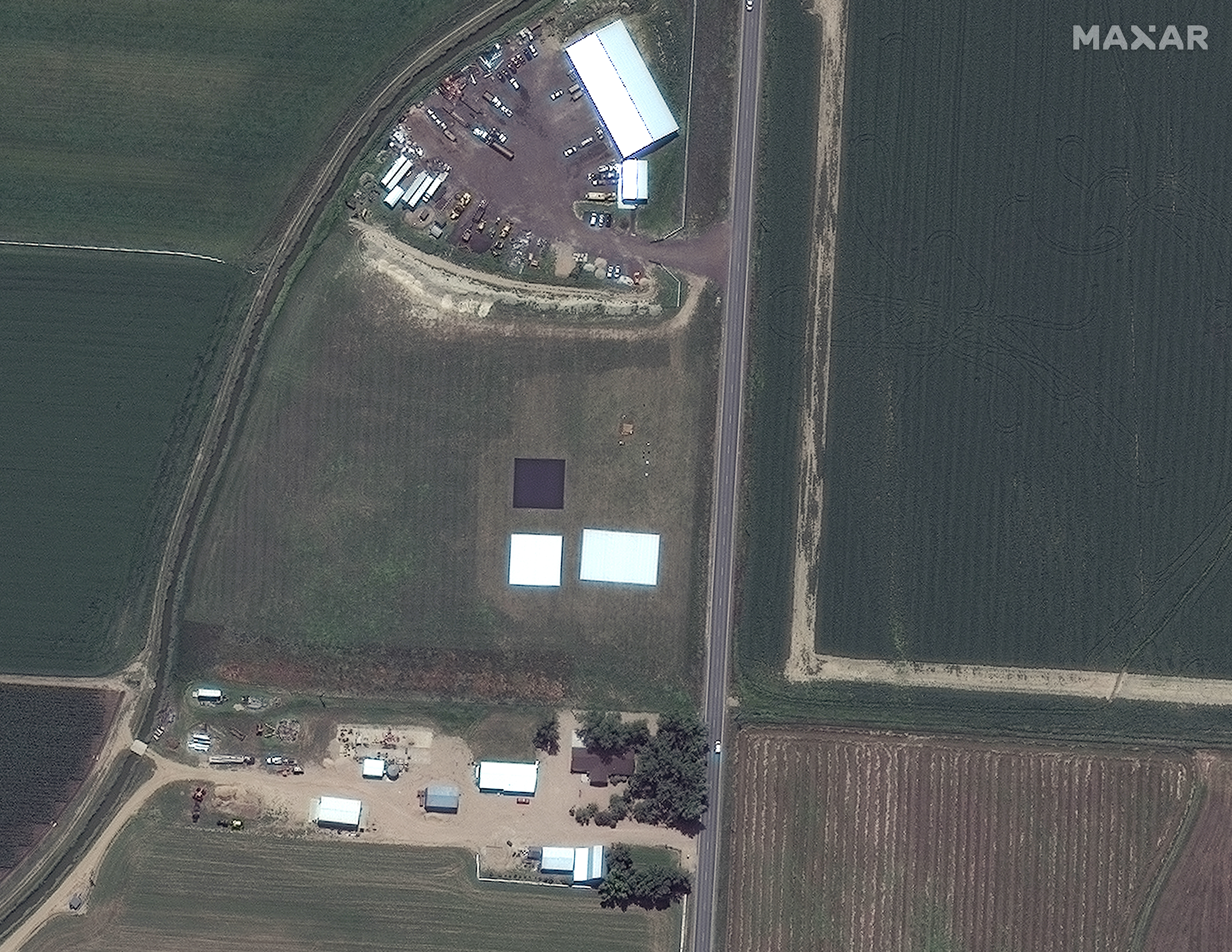
- Large, specialized calibration tarps that reflect the sun’s light at the same intensity across its surface. A tool called a field spectroradiometer (seen below) measures that reflectance, which is the main measurement collected. While we make these measurements, the satellite that’s being calibrated will image this tarp at the same time.
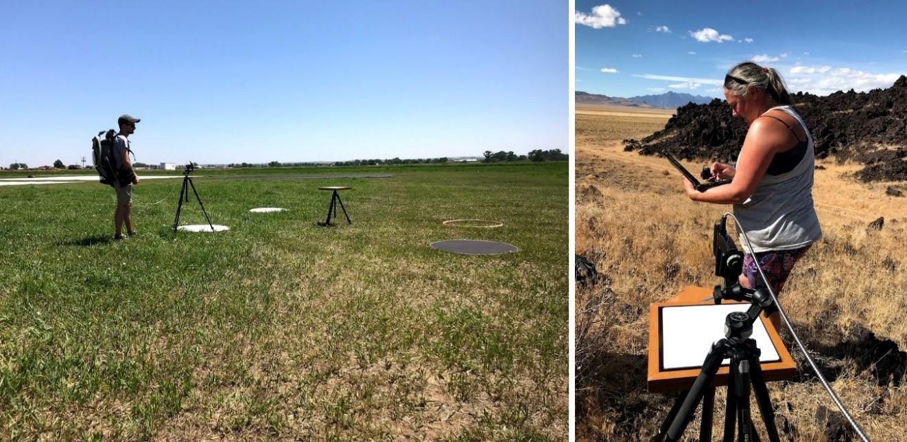
- Weather stations collect temperature, pressure and wind speed and direction data. These datasets help us understand what the atmosphere is doing during a calibration event so that we can compensate for it in our calculations.
- A sun photometer tool linked to the NASA Goddard AERONET networkgives us optical depth, water vapor, ozone and carbon dioxide amounts, single scattering albedo and asymmetry parameters. These are special atmospheric measurements that help us to determine what is in the atmosphere, how much of it and how it is affecting the scattering of the Sun’s rays as the light travels from our calibration target (the specialized tarps) to the satellite’s camera.
We use physics equations on the ground-based data serving as the calibration source to determine a “truth” measurement for the image pixels from the satellite being calibrated that are within the calibration targets. If a sensor is calibrated well, then the image pixel will have the same radiance amount as the predicted “truth” for that pixel. A collection of predicted “truth” values versus the imagery pixels reported values can be used to tweak the satellite sensor output until the pixels report the expected “truth” value. These tweaks carry over to other calibration targets across the Earth, allowing Maxar to create an absolute radiometrically corrected set of data from our imagery for scientists to use in their remote sensing work.
We do this data collection and comparison for every Maxar satellite, every color band, each direction the satellite can move (called scan direction), and every available camera exposure so that the imagery collected across the constellation with its many configurations are calibrated and comparable.
Maxar is an industry leader in providing scientific datasets to its customers, none of which would be possible without having industry-leading calibration.
Maxar’s calibration data is available to customers working with our high-resolution imagery so they can convert the data pixels to radiance and do science. You may view our most recent calibration results, presented at the Joint Agency Commercial Imagery Evaluation (JACIE) Workshop-2019 here. If you’d like a technical explanation of how we complete absolute radiometric calibration along with the most recent absolute radiometric calibration values and an explanation of how to apply them to our imagery, check out this white paper.