On Sunday, August 5, 2018, there was a devastating earthquake on the Indonesian island of Lombok. The most recent reports state that 350 have died, over 1,400 have been injured and more than 165,000 were displaced by the 7.0 magnitude earthquake. Lombok has a population of just over 200,000 people and is located in a mountainous region. Emergency response personnel have removed all of the 2,000 tourists on the Gili Islands as threats of tsunami have driven people to higher ground on the main island. While the full extent of the damage is still being assessed, mosques, schools and houses are among the thousands of buildings destroyed.
When crises like this occur, DigitalGlobe is committed to supporting the humanitarian community and fulfilling Maxar’s purpose of Building a Better World by providing critical and actionable information to assist response efforts. As part of our Open Data Program, DigitalGlobe will publicly release pre- and post-event imagery of the affected areas to support disaster response.
Pre and post-event DigitalGlobe imagery has been uploaded to the Open Data site. Please continue to check the site for updates on post-event imagery.
We will continue to update this blog post and our social media feeds as more data becomes available.
[caption id="" align="aligncenter" width="800"]
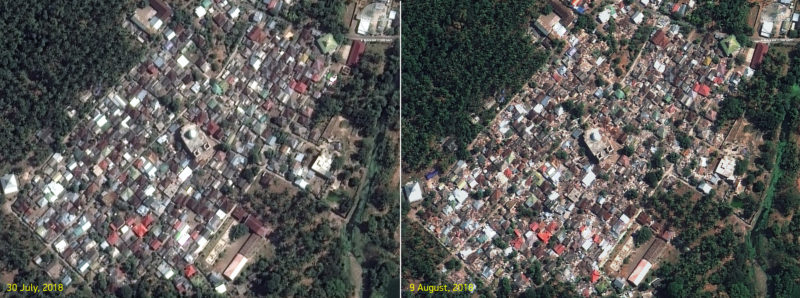
Before and after imagery of a village near Pamenang, Lombok Island, Indonesia.[/caption]