Today marks the 30-year anniversary of the passage of the Land Remote Sensing Policy Act, a landmark piece of U.S. legislation that helped jumpstart the formal commercial remote sensing industry.
Satellite imagery has always played an important role in society. The global transparency enabled by satellite imagery was one of the tools that kept the Cold War cold by enabling nations to act on the basis of facts and not fear.
The Act pushed the industry to new heights by establishing procedures to formally license private remote sensing companies and enabling them to operate in a true commercial fashion, while also reaffirming the importance of remote sensing for national and international prosperity. WorldView Imaging Corporation, which rebranded as EarthWatch and subsequently DigitalGlobe, a company that later became part of Maxar, received the first-ever remote sensing license a few months later in January 1993. The industry was off the races.
Over the past thirty years, the industry has had an immense impact on our daily lives—from safeguarding national security and helping deliver precise maps that improve modern navigation, to helping uncover the truths behind our changing planet and assisting reporters with chasing down some of the most important stories.
As an industry pioneer with more than 125 petabytes of data in our global satellite imagery archive, Maxar has a front seat to the growth and maturation of the remote sensing industry. On this important anniversary, we wanted to celebrate and reflect on five ways that the industry has helped build a better world.
1. Enabling precision mapping
Today, billions of people and millions of businesses around the world rely on precise mapping technologies to help make better decisions, such as deciding the route they take to their destination or optimizing business operations. These mapping solutions are often derived from, or supported by, highly accurate imagery basemaps produced from satellite imagery.

Maxar’s Earth Intelligence capabilities, combining high-resolution satellite imagery combined with artificial intelligence and machine learning algorithms, help deliver advanced precision mapping solutions.
For example, Maxar’s satellite constellation images more than one billion square kilometers of Earth each year, enabling us to deliver a highly precise and accurate imagery basemap that are helping a wide range of customers—from enhancing Esri's Living Atlas of the World, the foremost collection of geographic information, to helping mapmaking company TomTom quickly and accurately update its map layers to help its fleet management, ride-hailing service and other customers better navigate the real world.
2. Safeguarding national security and enabling disaster response
Geospatial data and imagery have become a critical component in helping the U.S. government and its allies provide global security and support humanitarian initiatives. The data provides near real-time insights to enable situational awareness and help users make the best decision to achieve the mission, whether it is supporting wartime missions or organizing disaster response efforts.

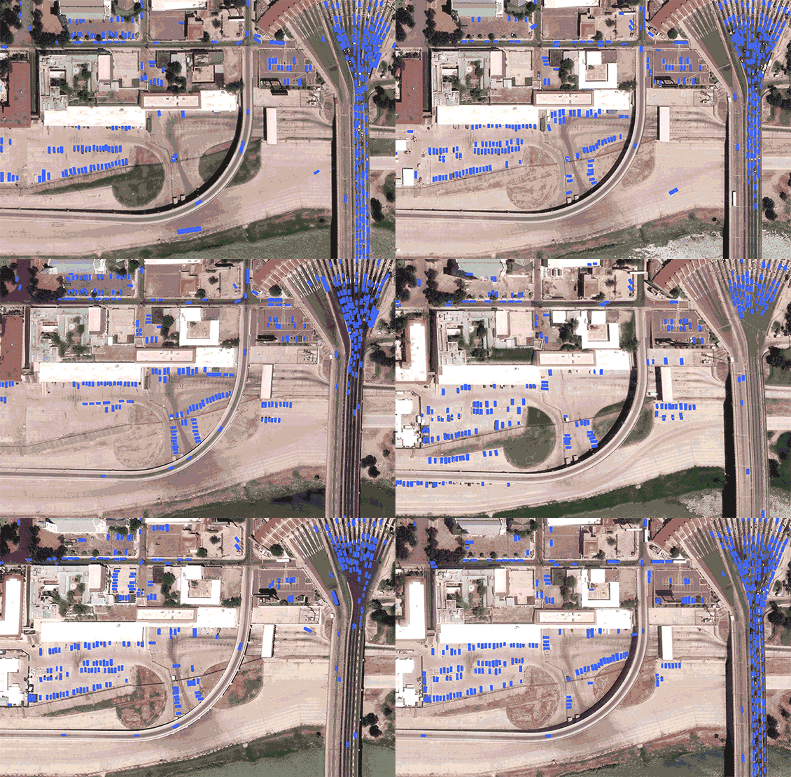
Maxar’s artificial intelligence and machine learning object detection integrated, streamed, and visualized in G-EGD.
Some examples: Maxar’s Global Enhanced GEOINT Delivery program, which was recently renewed, provides more than 400,000 U.S. government users with on-demand access to unclassified, high-resolution commercial imagery. And, Maxar’s Open Data Program provides nonprofit organizations with access to satellite imagery to help with relief efforts for situations from wildfires to pandemic response planning.
3. Bringing transparency to global events
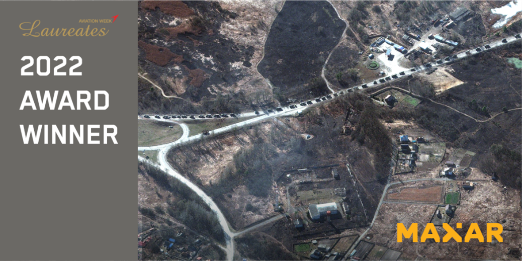
This year, the ongoing monitoring of the war in Ukraine brought the remote sensing industry into the public consciousness like never before, underscoring the industry’s importance in bringing transparency to global events. Satellite images provided primarily by Maxar’s News Bureau help combat mis- and disinformation, helping news organizations around the world accurately report events unfolding on the ground.

Aviation Week recognized Maxar as a 2022 Laureate Award Winner in the Space category for the company’s contributions to sharing data to assist Ukraine and reveal war crimes and human rights violations.
Satellite imagery has helped shine a light on global events for many years on topics ranging from illegal mining to human trafficking. In fact, Maxar imagery has been used in investigations that have won Pulitzer Prizes (three times), an Emmy Award and a Peabody Award.
4. Monitoring global change
Geospatial data also provides insights into monitoring change over time, which is important for understanding topics like climate change, wildlife populations and impacts to their environments, and urban planning.

This SWIR image is a false-color representation of an area in the Permian Basin using WorldView-3 SWIR bands 6, 7, and 8 to correlate physical features to the methane plume location. By using only three SWIR bands, the methane plume is illuminated in an orange color that stands out from the rest of the image.
Using different technologies like multispectral bands on the satellites, as well as artificial intelligence and machine learning on the imagery, can provide unique information for a better understanding. A few notable examples of these applications include mapping methane emissions, monitoring whale populations in the North Atlantic, and using information to support urban planning efforts.
5. 3D: Using geospatial data to build the real-world metaverse
The future of the remote sensing industry isn’t just 2D, it’s 3D. High-resolution geospatial data can be used to create highly precise 3D environments for use in a wide range of applications—from warfighting training and gaming, to film location scouting and educational programming. As a leader in 3D geospatial data, Maxar is on a mission to build a digital twin of the Earth.

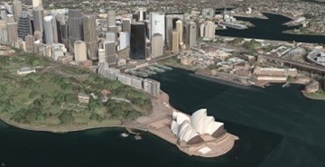
This Maxar 3D Surface Model shows a view of the Sydney Opera House in Sydney, Australia.
Maxar’s impact on the industry.
Revisit some of Maxar’s key accomplishments since the passing of the Land Remote Sensing Policy Act.
View timeline