Today, TomTom announced it integrated Maxar Vivid imagery basemaps into its consumer and business mapping solutions. TomTom is a leading mapmaking company serving drivers, carmakers, global supply chain operators and developers, and its digital maps just became more robust for millions of people around the world. The integration of Vivid imagery basemaps provides a current, real-life contextual layer across Earth’s entire surface, allowing users to toggle between digitally derived navigation map views and Maxar’s high-resolution satellite imagery.
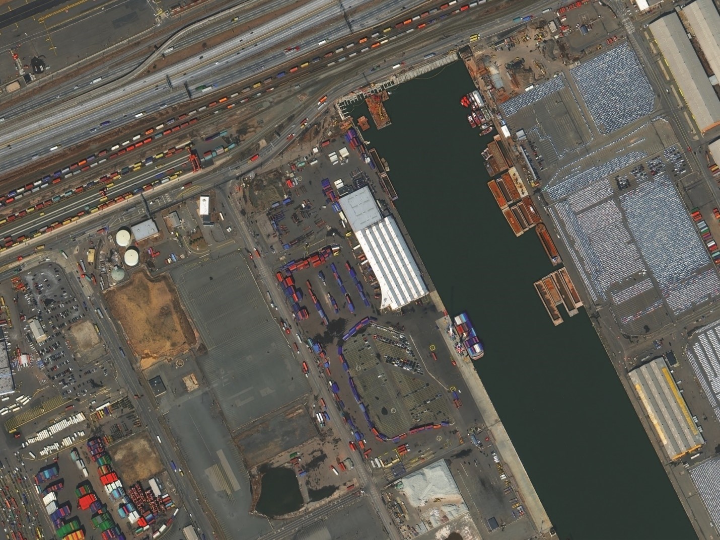
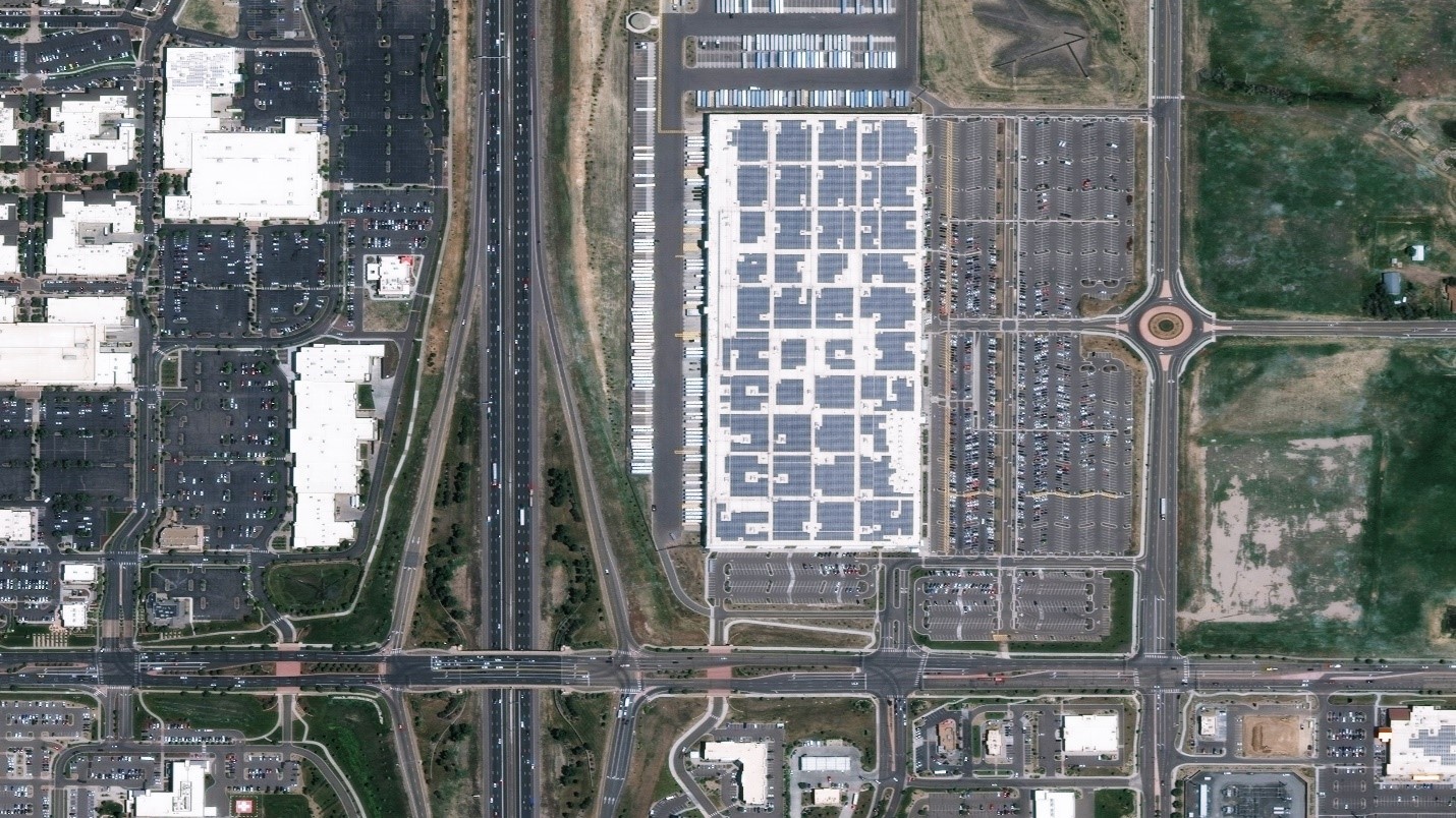
Maxar’s imagery basemaps provide a cloud-free, seamless view of Earth, with vivid natural color and precise visual clarity. Vivid basemaps provide a stunning, high-accuracy image layer over large areas to support mapping, visualization and analytics.
TomTom’s global coverage includes both Vivid Advanced and Vivid Basic basemaps. Vivid Advanced offers 30 cm resolution over the most populated and highest-interest areas of the world, while Vivid Basic is available across all remaining areas at 50 cm resolution.

Vivid basemaps are refreshed annually to maintain image currency, with Vivid Advanced basemaps providing the most recent coverage, typically less than one year old. This allows TomTom to provide up-to-date satellite imagery to their end users that reflect the current environment
Furthermore, with access to high-resolution imagery via Maxar SecureWatch, TomTom is able to quickly validate changes and make updates to its map layers derived from satellite imagery, such as roads, buildings and public spaces. SecureWatch offers simple access to more than 125 petabytes of Maxar satellite imagery, including more than 3 million sq km of imagery captured daily.
The integration of Maxar satellite imagery into TomTom services and applications has tangible outcomes for the people who rely on TomTom’s maps to safely and efficiently move through their environments. Let’s take a look at how the use of Vivid basemaps could benefit key customer segments:

Accurate in-vehicle navigation applications allow drivers to trust their maps and focus on the driving experience. Vivid basemaps provide a real-life visual reference of Earth’s surface for drivers, giving greater situational awareness of where they are and where they’re going. For casual drivers, high-resolution satellite imagery can help with ground-level orientation when traveling through unfamiliar areas.
For last-mile delivery operators, Vivid basemaps enable drivers to both visualize the end address and locate the actual front door or loading area, ultimately improving delivery time by reducing the amount of time searching on-site for the precise drop-off location.
For Fleet Managers efficiency is key. Keeping track of multiple vehicles, drivers and assets requires accurate and current information. Vivid basemaps allows them to visually confirm their drivers are taking the best, most effective route for on-time deliveries.

Successful pickups for ride-hailing services can make or break an overall experience, and pickup might not be as straightforward as sharing one’s GPS location. Sometimes a rider gives location details that don’t always show up on maps, such as, “I’m on the west side of the large fountain on Fifth Street.” With the availability of the Vivid basemaps layer, drivers can immediately view a high-resolution image that reflects the current reality on the ground, allowing the driver to quickly orient themselves and safely navigate to the closest spot for pickup.
Satellite imagery enhances consumer and business digital map solutions.
By integrating Vivid imagery basemaps into its consumer and enterprise maps, TomTom is providing a better map experience and an additional—very important—visual contextual layer of Earth’s surface that reliably reflects reality.
How can Vivid basemaps help your business?
Vivid basemaps enhance mapping solutions by providing readily available image layers with unmatched global accuracy, stunning visual clarity, automatic annual updates and flexible access options.