------------------------------------------------------------------------------------------------------------------------
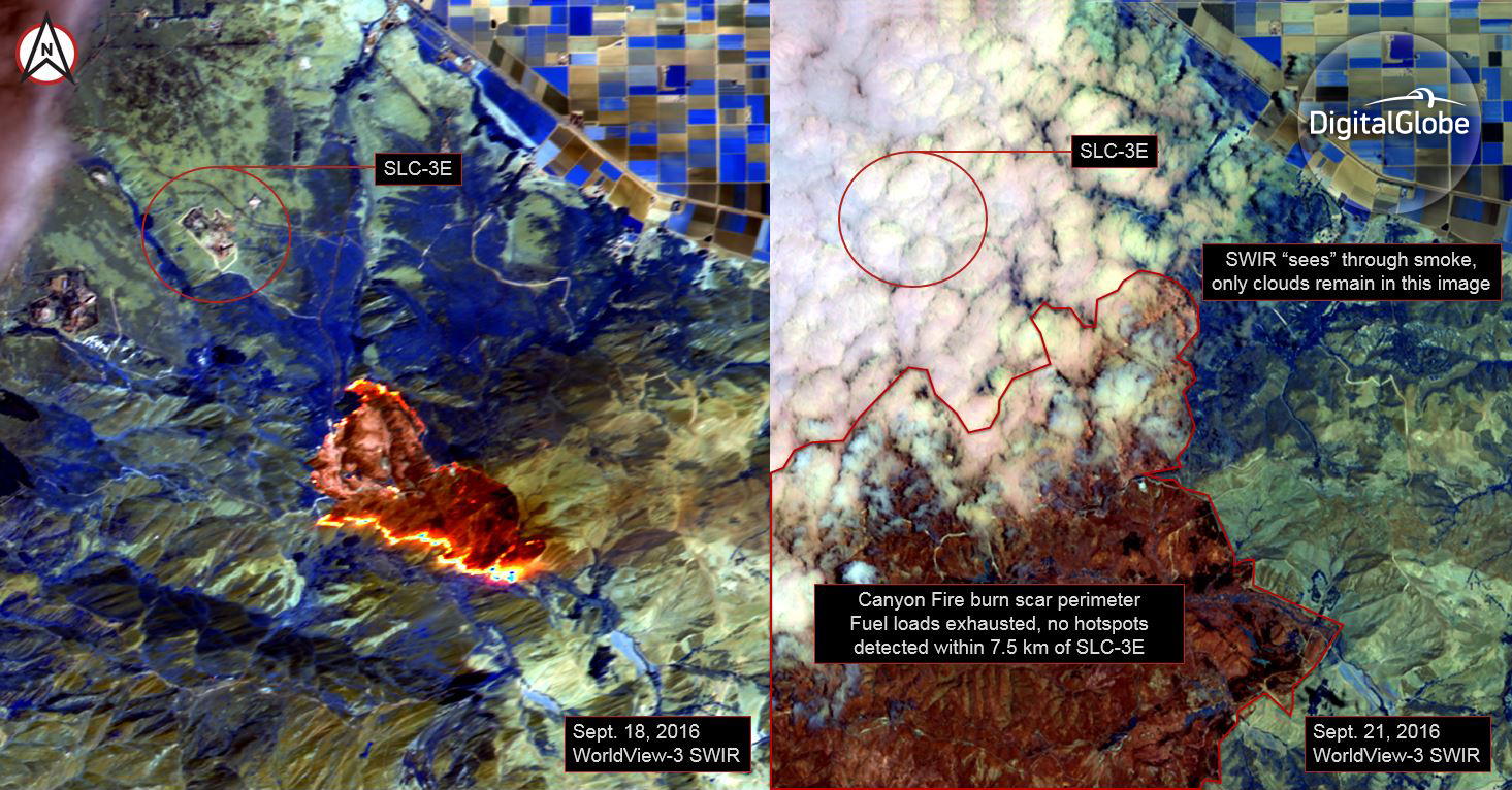
As announced earlier today by United Launch Alliance (ULA), the ongoing response to the wildfires at Vandenberg Air Force Base will cause the launch of DigitalGlobe’s WorldView-4 satellite to slip past its previously planned Sept. 26 date. We are working closely with ULA and the U.S. Air Force to identify a new launch date in early October. We are pleased to see that the fires are now 70% contained, and there is no risk to the spacecraft or launch vehicle. We are deeply appreciative of the more than 1,100 brave men and women who have battled this blaze, and we are tremendously saddened by the death of Ventura County Fire Department engineer Ryan Osler, 38, who was killed yesterday while en route to the fires. For anyone who would like to honor him, a Ryan Osler Memorial GoFundMe page has been set up to support his survivors, his wife and two children. DigitalGlobe has been imaging the Vandenberg area each day since the fires broke out and providing this imagery to response teams on the ground. Our WorldView-3 satellite captured the image on the left four days ago, and the image on the right yesterday. These false-color images were taken with the satellite’s shortwave infrared sensor, which is uniquely able to pierce through smoke and see where fires are burning on the ground. Four days ago, the fire line (shown in bright orange) was as close as 2.5 km from the Space Launch Complex (SLC)-3E. By yesterday, there were no active fires in this area (those are clouds obscuring the launch pad in yesterday’s image). As we often say at DigitalGlobe, space is hard. When you’re launching a valuable asset that customers will rely upon for a decade or more, conditions must be just right, and every risk must be mitigated to ensure mission success. There are dozens of organizations and thousands of people who have contributed to the development and launch of WorldView-4. Once in service, this satellite will further enhance our customers’ and end users’ ability to make critical decisions with confidence, and ultimately save lives, resources, and time.