Global Basemap and UC San Diego’s Big Pixel Initiative
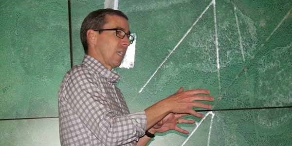
“It’s pretty incredible to realize the power of remote imaging in our modern age, where a top view perspective can capture and quantify with high fidelity the dynamics of our very existence,” said UC San Diego Research Scientist Dr. Albert Lin. “Then, when you get a sense of the depth of the archive, it becomes clear that we are on the brink of something big—a moment when vast scales of data combined with powerful computation will change the nature of the questions we can even ask.” This is the basic principle of the Big Pixel Initiative (BPI) started at UC San Diego to provide researchers with unique access to DigitalGlobe’s Global Basemap, made possible by the partnership between the university and DigitalGlobe Foundation. “Having access to DigitalGlobe Basemap will allow researchers to ask questions and derive answers at a scale that is truly global,” said Gordon Hanson, economics professor, director of the school’s Center on Global Transformation, and co-director the Big Pixel Initiative with Dr. Lin. “By combining geospatial data with state-of-the-art research in fields such as public health, economics and ecology, we should be able to glean insights that were not previously possible.” [caption id="attachment_4164" align="aligncenter" width="700"] UC San Diego Economist Gordon Hanson discussing the power of GBM at BPI faculty workshop.[/caption]
DigitalGlobe Basemap in Action
To put this into action, the BPI team conducted a series of campus-wide activities with DigitalGlobe’s Global Basemap. Initially the team launched a cross-departmental faculty workshop to familiarize leaders from computer science, visual arts, political science and the Scripps Institution of Oceanography with satellite imagery. Soon after, the campus hosted a day-long GBM hackathon with PhDs and Masters students from both computer science and the social sciences. The theme: “What Will You Discover?” [caption id="attachment_4165" align="aligncenter" width="725"] Teams of students developing research questions centered on Global Basemap at UC San Diego’s inaugural BPI hackathon.[/caption]
Students competed to develop the most compelling research questions that could be explored through imagery at scale. Winning ideas included an algorithmic approach to global quantification of informal settlements, and a meshing of imagery and global ship tracking data to separate permitted from unpermitted boats to identify illegal smuggling routes.
Following these activities, eight mini-grants ($15,000) were provided to a broad cluster of researchers. The only requirement for the cross-disciplinary efforts was that they used satellite imagery to ask big questions. For example, one team of researchers from the math department developed an algorithm to identify refugee camps through high-resolution data—an effort to quantify the movements of a highly dynamic and hard to measure populations. Another project used imagery to quantify the expansion of urbanization across India over the last decade and its relationship to social economic dynamics.
“I am excited,” said Dr. Ran Goldblatt, a postdoctoral researcher at the Big Pixel Initiative. “Utilizing big data to understand our world, how it changes and the relationships that drive it is what I want my research carrier to focus on.”
Some early results from his work with Hanson using satellite imagery to survey 30,000 mines across the world has shown that global economic cycles and booms in mineral commodity pricing has a significant impact on forest cover loss, at scale.