Editor’s note: This blog post is the second post in a series about Maxar’s Vivid, Metro and Dynamic basemaps. Read the first post titled, “Advances in Satellite Imagery and Technology Cause a Basemap Evolution.”
As populations, infrastructure and supply chains expand around the globe, it’s important to have up-to-date and spatially accurate maps. Maxar’s imagery basemaps help government, global development and commercial organizations derive insights that mitigate risks, inform decisionmakers and protect communities and their environments.
The science behind our basemaps ensures maximum clarity and spatial accuracy, which are critical specifications for developing valuable new technologies such as high-definition (HD) maps for autonomous vehicles that need to understand every curb, lane boundary, right-of-way and traffic light. So how do we build our imagery basemaps?
It starts with our high-resolution satellite imagery. Maxar invests in long-life satellites with high-precision attitude and orbit determination sensors that use the stars and ground to optimize locational accuracy. The imaging instruments carried by these satellites have large apertures, which enable complete coverage of large areas in a single pass.
When combined, our large aperture sensors and positioning technology enable us to see significant details in the imagery—the highest resolution commercially available: 30 cm. We currently collect more than 3 million sq. km of high-resolution satellite imagery every day, with the flexibility to collect areas of high-interest anywhere on Earth.
While the raw data is high quality, we do need to make it easier to work with for our customers and scientists. We can also use the information contained in the data to improve its quality further. Here’s some of the processes we run on the raw data:
- Bundle Block Adjustment (BBA) is an internal process that leverages the positional information in a collection of images to refine the accuracy across each image. This results in smoother seamlines across basemaps and better alignment of vectors like roads and building footprints. BBA runs through Amazon Web Services (AWS) and offers unprecedented scalability for 30-50 cm satellite imagery, often completing large area orders in less than a day. We can apply BBA to blocks of high-resolution imagery well over 1 million sq. km. This supports consistent and industry-leading accuracy for basemaps on the scale of states or even many countries.
The image on the left shows an example basemap seamline without BBA (notice how the road is not aligned at the seam). In the image on the right, BBA was applied, resulting in better relative accuracy (the road matches up).
- Post-collection image rectification reconciles the height variations that naturally occur on the ground to the flat images we see on our computer screens. This part of the process ensures that every pixel in the image is assigned the correct coordinates from the ground, making steep height variations a non-issue.
- Flexible Large Area Mosaic Engine (FLAME) is an AWS-native Maxar service for building (or updating) seamless, consistent, sub-meter basemaps at incredible scale. It enables us to create a consistent look and feel across thousands of individual satellite collections, delivering a product that looks as if it was collected in a single pass. Orthomosaics built with BBA and FLAME typically achieve between 2 m-5 m CE90 absolute accuracy, even without Ground Control Points.
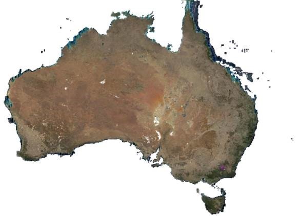
Maxar created this Vivid basemap of Australia using our FLAME service.
Refining and integrating these end-to-end capabilities enables Maxar to build the highest quality foundational imagery basemaps in the world. This strong foundation means that derived information, such as 3D elevation models, road networks, buildings, vegetation and water are extracted with greater precision and recall.
Explore Maxar imagery basemaps.
Learn more