Many countries around the world go years without conducting a nationwide census or lack the resources to reach across their entire population. Outdated and incomplete census data impact socioeconomic development and preparedness of public health systems, crisis response and other programs.
It also limits government accountability and transparency. It is no wonder, then, that countries with outdated social statistics and reports of corruption also experience significant social unrest. Fortunately, advances in remote sensing provide a means to evaluate population vulnerability in the absence of census data, enabling governments, intergovernmental organizations and NGOs alike to assess population vulnerability at scale by analyzing a city’s layout, development and distribution of services.
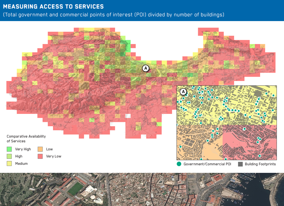
This issue of Maxar Spotlight focuses on Algiers, Algeria, which is comprised of an extremely young population (70% under 30 years of age) and is experiencing rapid urbanization. Utilizing Human Landscape data and Ecopia Building Footprints powered by Maxar, our analysts identify specific neighborhoods in Algiers that are more likely to be disengaged from politics and the economy—where government should prioritize community revitalization efforts and improve engagement, outreach and messaging.
Read the periodical in full to gain a better understanding of how Maxar’s Earth Intelligence capabilities can help reveal patterns of life and insights to predict, mitigate and resolve crisis and conflict.
One Maxar.
Unlocking the promise of space to confront challenges on Earth—and beyond.
Fill out the form to access the latest edition and subscribe to the Spotlight:
Sneak Peek: (excerpt from Maxar Spotlight, Vol. 22)
Urban form analysis
According to data from The World Bank, Algiers is among North Africa’s fastest growing cities. Its population has also grown increasingly discontent with the government. Many fiscal policies and well-intended subsidies have favored the wealthy, and corruption continues at all levels of leadership. Significant income inequality and a high unemployment rate, particularly for those under 30 years of age (roughly 26%), have shown no signs of abating. These factors have contributed to social unrest, emigration and the pervasive growth of Algiers’ informal economy. Following a year of widespread protests and the resignation of 20- year president Abdelaziz Bouteflika, the future peace and stability of Algiers appears to be in flux.
This Spotlight provides an assessment of Algiers’ more socially and economically vulnerable neighborhoods by modeling the city’s urban form. The assessment is based on the notion that lower-class neighborhoods have specific physical properties. It is intended to demonstrate how Maxar satellite imagery and machine-learning processes can generate building footprint polygons and urban form measurements at speed and scale.
