 Smallholder farmers depend on growing their own crops as the primary source of their livelihoods. (Photo Attribution: Stephen Morrison/AusAID)[/caption]
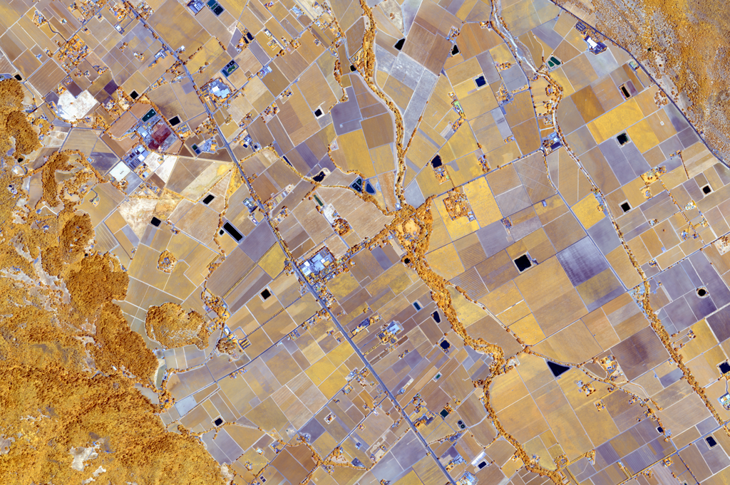
Through its Seeing a Better World™ Program, DigitalGlobe is partnering with scientists of STARS Project (Spurring a Transformation for Agriculture through Remote Sensing) to provide better information in order to increase productivity and decrease vulnerability for millions of family farmers who often have plots of land no bigger than a football field, and may face insecure tenure on that land. Satellite imagery is the ultimate force multiplier for smallholder farmers, who today have few options to diagnose crop health, identify appropriate responses, forecast expected production, or access credit and financial services to improve their productivity. DigitalGlobe’s very high-resolution, super-spectral imagery provides many key agricultural data points, such as water availability, the nitrogen content of plants, crop vigor, and evidence of continued care of the land over time that could be used for collateral.
Under the initiative that began in early 2014, DigitalGlobe is providing information derived from its visible and very near-infrared satellite imagery to monitor crop growth at the level of the farm plot of the smallholder farms found in sub-Saharan Africa and South Asia. Our ultimate goal is improving estimates of crop yield as the season progresses, and generating better, evidence-based advisories for on-farm and around-farm practices such as those by extension services and the private farm inputs sector.
[caption id="attachment_2830" align="aligncenter" width="573"]
 Technological advances in remote sensing have created a unique opportunity for implementing smarter solutions for smallholder farmers globally.[/caption]
At the macro level, satellite imagery can inform regional or national governments about the volume and location of various crops across vast agricultural areas. For example, the private sector and extension services require location-based farming information to optimize their operations; and national food security agencies need early forecasts of the expected production to allow optimal use of national food acquisition budgets. Therefore, imagery products can help produce improved statistics and anticipate harvests so that appropriate trade policies can be selected and areas of surplus can be mobilized to supply areas of deficit, preventing food shortages and hunger.
The DigitalGlobe whitepaper “Remote Sensing Technology Trends and Agriculture” provides a more in-depth look at the technological advancements in remote sensing, cloud computing, mobile technology, and GPS techniques that have created a unique opportunity for implementing smarter solutions for smallholder farmers globally. This publication is based on research funded in part by the Bill & Melinda Gates Foundation.