Nine years.
Millions of volunteers.
Zillions of square kilometers of satellite imagery analyzed.
Tomnod, the world’s first satellite imagery crowdsourcing platform, started as the quest of a few University of California San Diego graduate school students to find the ancient hidden tomb of Genghis Khan in northern Mongolia. These students asked the public to help them tag features in satellite images of Mongolia, creating a map of the area and allowing them to focus their search. After successfully finding clues, which narrowed the search for the location of the tomb, the Tomnod platform was born, creating a thriving community of volunteers who made a difference as citizen scientists.
Tomnod, which means “Big Eye” in Mongolian, was groundbreaking technology at the time of its creation and supported humanitarian response efforts, large-scale public mapping projects and generally helped Maxar serve our purpose For a Better World. As the geospatial industry has evolved, we have seen the most customer demand for crowd-sourced image tagging come from those looking to train artificial intelligence and machine learning (AI/ML) algorithms, which need thousands of tags to learn what they are looking for. We have also observed that once those AI/ML algorithms are trained, they provide great results at tremendous scale. But another shift is that our customers want to know who is creating their training data. This has fundamentally changed the business of image tagging by the crowd and we are evolving with this change.
Due to this shift in our approach, we are winding down the tech behind Tomnod and ramping up Maxar’s GeoHive, a related platform that allows customers to select their crowd.
We would like to thank the millions of Tomnod volunteers who devoted countless hours to contributing to our campaigns. Together, the power of the crowd has combed through many millions of square kilometers of satellite imagery tagging the requested features. These volunteers and Tomnod have made an immeasurable impact on the world in all kinds of situations, so let’s look back at some of Tomnod’s most memorable campaigns:
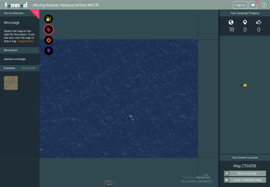
2014 - Missing airplane: Malaysia Airlines MH370

Malaysia Airlines Flight MH370 and its 239 passengers vanished from radar while en route to Beijing from Kuala Lumpur on March 8, 2014. More than 1 million square kilometers of satellite images were loaded into Tomnod and volunteers were asked to tag oil slicks, wreckage, rafts and other objects of interest. More than 10 million people contributed, which at the time was more web traffic than Instagram users. More than 14 million tags were placed during 775 million map views, giving first responders key clues on where the plane might be found. The mystery of MH370’s location endures today.
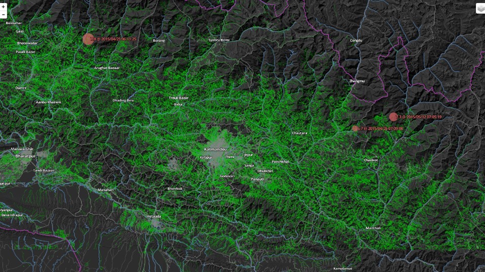
2017 - Mapping to eliminate malaria
Health workers need basic information, like where people live, to bring assistance to those in need. Tomnod helped identify areas where people live in Southern Africa, Central America and Southeast Asia. The crowd tagged image tiles covering hundreds of thousands of square kilometers with a “yes” or “no” if a building was present. The “yes” tiles were presented to the OpenStreetMap (OSM) crowd for tracing, focusing their efforts and allowing the mapping project to be completed in weeks. This project, funded by the Bill & Melinda Gates Foundation, was implemented in partnership with Humanitarian OpenStreetMap Team, PATH and Clinton Health Access Initiative, and used the new maps to bring malaria elimination efforts to these communities.

2015 - Crowdsourcing a damage assessment for the Nepal Earthquake
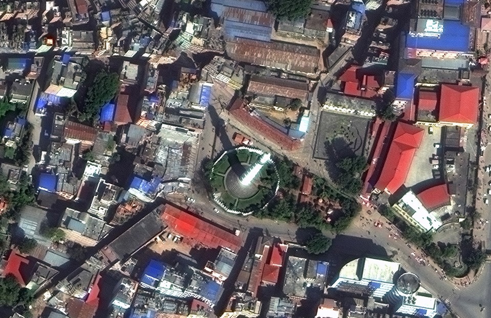

A 7.8 magnitude earthquake and 31 aftershocks hit Kathmandu, Nepal in April 2015, causing about 9,000 deaths and damaging more than 600,000 structures. More than 58,000 volunteers analyzed 14,700 km2 of satellite imagery on Tomnod, ultimately tagging more than 21,000 damaged buildings, roads and areas of major destruction, providing key information to first responders.
The Nepal earthquake was among the first disaster response campaigns Tomnod supported. Back in 2010, Tomnod also aided the response to the Haitian earthquake. The results of these campaigns were impactful for first responders on the ground, which sparked the idea for Maxar’s Open Data Program, which provides open-source satellite imagery and data layers for select, sudden on-set natural disasters.
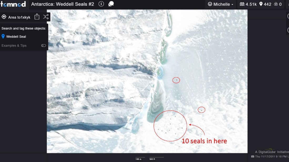
2016 - Counting seal populations in Antarctica

The Tomnod community helped researchers survey the Weddell seal population in Antarctica to help them understand where seals like to live. In less than two months, about 5,000 volunteers covered the same amount of area that a ground-based research team covered in a decade!
“The Weddell seal campaign was possibly one of the most impactful pieces of research that I have been involved in,” said Dr. Michelle LaRue, Research Ecologist, Department of Geography & Gateway Antarctica at the University of Canterbury. “In terms of expanding our knowledge about these animals, where they live, why they choose certain places over others, it’s simply incredible. There is no other way to address these kinds of questions than through Tomnod.”
What’s next?
Stay tuned for new opportunities to engage with our imagery. We will announce what’s next for crowdsourcing at Maxar on our Facebook and Twitter accounts. In the meantime, follow us on Instagram to get a daily view of our world from space and subscribe to The GISt, geospatial stories for the curious mind.