 Andy Dinville, Senior Manager, DigitalGlobe Analytics
The recent flooding event that impacted a portion of Colorado’s front range between the Colorado Springs area and the Wyoming border caused unprecedented evacuations and wide-spread damage throughout the region. Once the flooding began, DigitalGlobe activated a FirstLook event, making before and after high resolution satellite imagery of the affected areas available to first responders and government agencies (e.g., Federal Emergency Management Agency, The Red Cross, National Guard, etc.) for the purpose of planning and maintaining situational awareness of the event. FirstLook allows DigitalGlobe to provide much needed insight to those on the ground, within a short amount of time. DigitalGlobe's high resolution satellite images combined with its geospatial analysts’ expertise provide actionable information for first responders in near real-time.
Early on, the event imagery was collected through a brief break in the clouds between the Lyons and Longmont areas of Colorado, north of the Denver metropolitan area. Flooding occurred in urban areas, low-lying ground and storm water drainage. The hardest hit areas, however, were along the foothills between the Rocky Mountains and central Colorado, where moisture-rich upslope winds produced more than a foot of rainfall in localized areas.
In Lyons, Colorado, imagery and analysis confirm that the McConnell Drive Bridge, providing primary access to neighborhoods and schools in the area, was washed away completely. Ongoing flooding is also visible along the St. Vrain River that exits Lyons to the southeast.
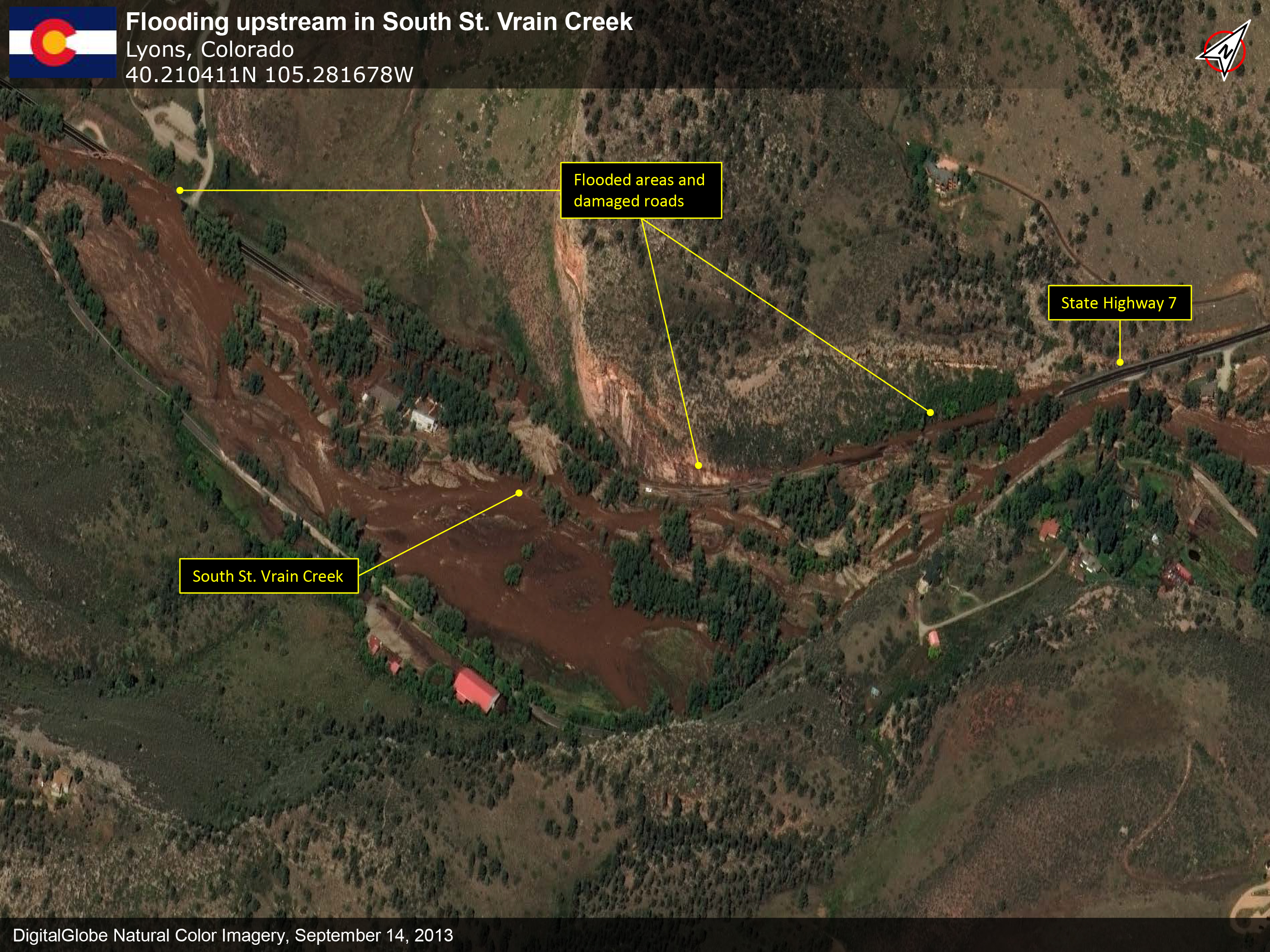
Not far upstream, where the North and South St. Vrain Creeks combine to create the St. Vrain River, major flooding of the rest of the south side of Lyons is visible. Upstream along the North St. Vrain Creek, the Button Rock Dam and Reservoir reveal water levels near to the top of the dam. Just southwest of Lyons, along the South St. Vrain Creek, extensive damage to Colorado Highway 7 is visable. The area shows indications of debris and wide-scale flooding, hinting at the volume of water that roared through these canyons during the peak flooding.The St. Vrain River flows from Lyons to Longmont. The next slide shows the affected flooded areas between the locations. Out on the plains, the water pushed through, over and around the embankments meant to control the river.
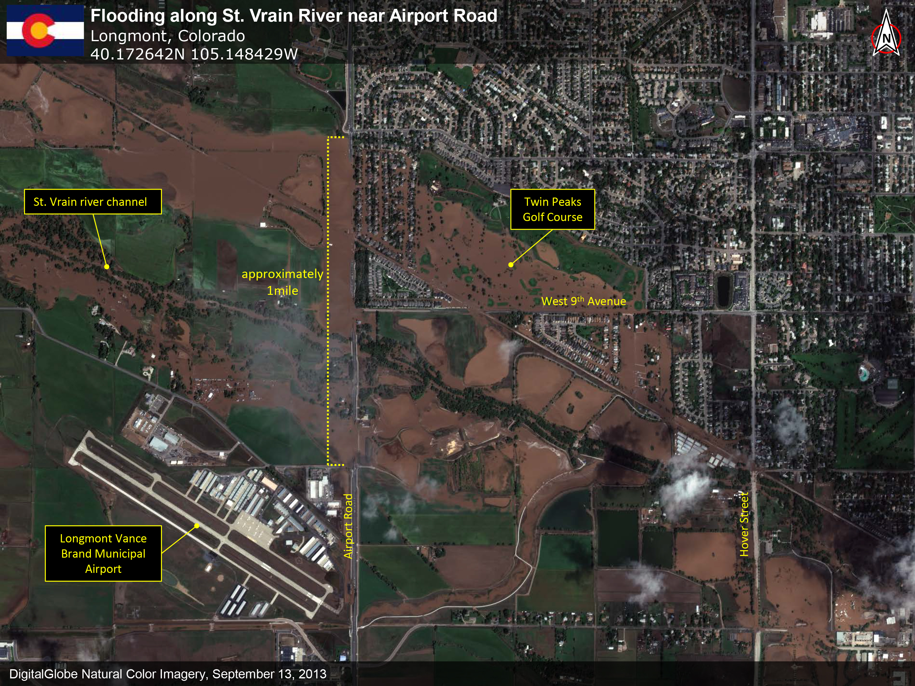
Longmont bore the brunt of the St. Vrain flooding. The river enters the city on the west side, near the Vance Brand airport, and nearly bisects the city. The flood waters spread through the city, extending the boundaries of the river up to a mile wide in some areas, and engulfing low-lying residential, commercial and industrial areas from one end of the city to the other. On the southern end of Longmont, Left Hand Creek, which also experienced severe flooding, flows through several residential areas on its way to the St. Vrain river. Flooding along this corridor is visable as control ditches strain under the force of the flood waters. Several miles south of Longmont, along 95th Street, Boulder Creek washed across the low-lying areas of the roadway. 95th Street remains closed at this time. In addition to DigitalGlobe’s analysis, our team at Tomnod has launched a crowdsourcing campaign to help map the damage. Join the campaign and help us! http://tomnod.com/nod/challenge/coloradofloods2013 You can also view and download the complete report below.


