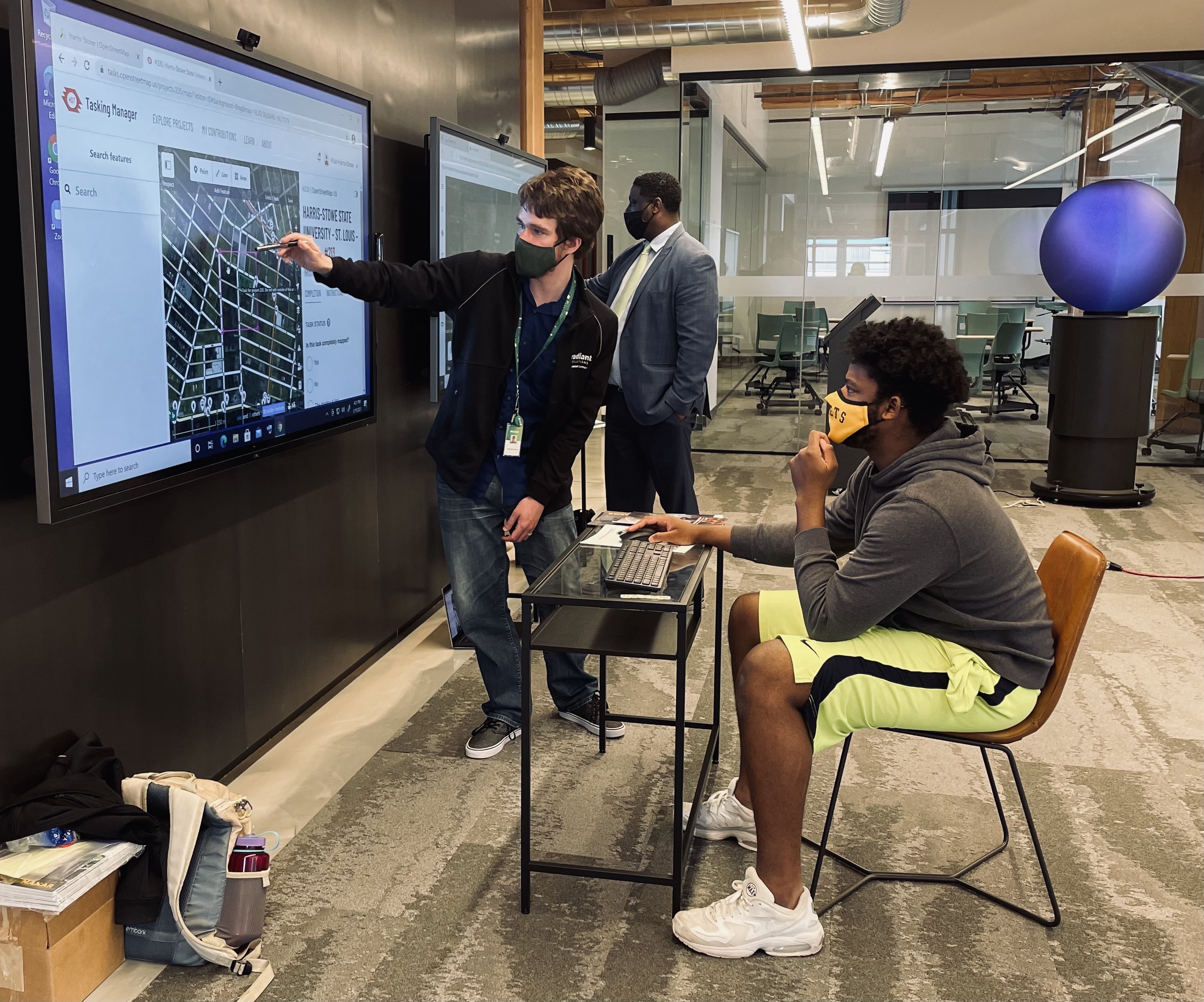
The OpenStreetMap program has a more detailed and accurate depiction of north St. Louis, thanks to 12 Harris-Stowe State University students who participated in the GeoHornet Mapathon March 19, hosted by Harris-Stowe State University with participation by Maxar and the National Geospatial-Intelligence Agency.
NGA’s involvement in the mapathon was in support of the Education Partnership Agreement it signed with HSSU last fall.

Students from Harris-Stowe State University participate in the GeoHornet Mapathon March 19, hosted by Harris-Stowe State University with assistance by Maxar and the National Geospatial-Intelligence Agency. This Mapathon was the first in a series of GeoHornet mapping efforts by Harris-Stowe and participating organizations to coordinate and facilitate the improvement of open geographic data in St. Louis.
The mapathon mapped nearly 600 buildings in north St. Louis and gave the students an opportunity to develop their mapping and geospatial technology skills and preview what a career in the geospatial industry might be like.
“By filling data gaps in OpenStreetMap, the GeoHornet Mapathon is introducing geospatial technology to students and growing geospatial skillsets,” said Freddie Wills, assistant vice president for STEM initiatives at Harris-Stowe State University. “It also is driving application of geospatial data across multiple academic disciplines to benefit students, teachers, the St. Louis geospatial economy and local residents.”
OpenStreetMap is a free, online map of the world, available to be viewed and edited by anyone. Millions of people around the globe contribute to it, according to its website. Individuals, humanitarian organizations and more use its data, and it is the basis for many map-based or -enabled smartphone apps.
“Maxar is proud to help the next generation of mappers learn how to create maps to have an impact in their communities,” said Matthew Gibb, Maxar’s supervisor of geospatial tradecraft, who served as a mapping coach for students during the event. “Maxar’s high-resolution satellite imagery serves as a foundational mapping layer for OpenStreetMap, which allows the derived mapping information to maintain the same geo-accuracy as our imagery.”

Christopher Buechner, a volunteer mentor from Maxar, teaches a Harris-Stowe State University how analyze imagery through OpenStreetMap software.
One goal of the GeoHornet Mapathon is to support local neighborhood development and improvement, said Wills.
“Insight and information submitted by Mapathon participants can create more robust maps of under-developed St. Louis northside neighborhoods,” said Wills. “These maps can then be used for research projects or development planning by students, researchers, government and industry.”
Another goal of the mapathon series is to build a community of mappers and geospatial professionals in St. Louis, said Wills. By facilitating student interest and expertise in geospatial science and programs, particularly as these fields relate to the real-world technical applications, the mapathon is helping to develop a future workforce in support of the St. Louis geospatial ecosystem, which includes Maxar and NGA.
“Events like this are the foundation for developing an understanding of GEOINT – terms, applications, methodologies, etc.,” said Luke Kratky, who leads special projects for the Senior GEOINT Authority for Geomatics for NGA. “As we look to demystify STEM, GEOINT and NGA, community integration events like this is how we mentor, coach, develop and capture the imagination of potential STEM students.”
Because of COVID-19 precautions, coaches from Maxar and NGA personnel participated on-site at Harris Stowe’s GeoHornet Lab in the T-REX innovation center in downtown St. Louis and virtually to help answer student questions and discuss geospatial careers.
Students came from different majors and backgrounds.
Donovan Forrest, a Harris-Stowe senior and business major, is a resident of north St. Louis and lives near the site of the new Next NGA West facility, he said. He opted to participate in the mapathon because he wanted to learn more about NGA and potentially join the agency after graduation. Now, Forrest said he sees a future in geospatial technology, and looks forward to learning more about the world of geospatial intelligence as a result of the event.
Christopher Buechner, a volunteer mentor from Maxar, spent one-on-one time with the students, helping them understand how to work the OpenStreetMap program and the role of an imagery analyst.
He said he enjoys getting students involved with mapping their own areas and introducing them to the world of geospatial.
“There is something about mapping local that hits home with me,” said Buechner.

Christopher Buechner, a volunteer mentor from Maxar, shows HSU student Donovan Forrest how to analyze and map through the OpenStreetMap program.
This Mapathon was the first in a series of GeoHornet mapping efforts by Harris-Stowe and participating organizations to coordinate and facilitate the improvement of open geographic data in St. Louis. Wills said Harris-Stowe plans to hold future mapathons that will seek to engage high school students, residents from North St. Louis and residents from across the St. Louis region.
Approved for public release #21-424