Digital mapping as a discipline emerged in the 1960s, when the U.S. Census Bureau used geographic information systems (GIS) and digital cartography to fully understand and visualize population trends. Since then, the abilities of geospatial data collection and problem-solving have exploded. Innovations in digital tools for gathering, visualizing and analyzing geospatial information created new possibilities for public and private sector organizations alike. In a sense, mapping’s digital revolution launched the democratization of maps: they became easier to build, transport and share—and opportunities and marketplaces for satellite imagery as a source of ground truth were born.
Opportunity had its limits
Despite digital mapping’s seemingly limitless opportunities, significant obstacles remained. Procuring images in strips one by one was expensive, slow and did not facilitate customization of specific areas. What’s more, fixed satellite collection plans made it difficult to keep maps up to date with the rapidly changing world below. At times, the race to innovate delivered compromised accuracy and image integrity; different systems, methodologies and projections in their early stages caused inconsistencies in conflation and matching.
As free tools like Google Earth put basemaps in the hands of the masses, mission-focused organizations realized the potential of professional-grade imagery basemaps. They understood that having a true view of the locations and resources that mattered most to them would bolster their business intelligence. Maxar was instrumental in this history—and continues to lead the imagery basemap business.
The leader in sophisticated Earth imagery
Maxar has been the trusted partner for map-ready and analysis-ready imagery basemaps—from the early days of digital mapping, when customers used manual methods to extract features and create map data layers, to recent years as customers transition to large-scale automated feature extraction using artificial intelligence and machine learning.
First, Maxar launched Global Basemap in 2011: a catalog of map-ready image strips accessible online. This product offered imagery across the globe and a commitment to cover the landmass in mosaics–one degree cell at a time. While the buildout of small-scale mosaics offered improved efficiency and aesthetics for our mapping customers, we understood the need to go bigger.

Improved efficiencies at country scale
Fueled by advancements in cloud computing and machine learning, Maxar introduced the first ever high-resolution, country-wide basemaps in 2013 that delivered near-seamless, large area coverage. Consistent resolution and accuracy across these much larger areas offered customers the enhanced ability to locate resources, extract features and plot points of interest on a basemap that covered the entirety of their large areas of interest. The result: a mapping revolution of sorts. Uniform countrywide maps became a reality, and large-scale imagery basemaps delivered unparalleled image quality and premium content—and in turn, greater customer confidence.
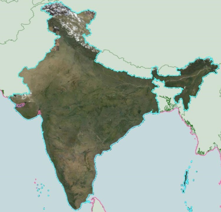
Image integrity over speed to market
Competition abounds. While others in the industry may bring updates online faster, their speed to market compromises resolution consistency and image accuracy. Their basemaps are often a patchwork of imagery that has different resolutions, which trained machine learning algorithms can’t navigate easily. As a result, their customers find it difficult to extract ground features at scale, causing the customer to map the features manually, wasting time and valuable resources.
Maxar prioritizes the needs of modern-day mappers over speed, building reliably consistent resolution and accuracy into every image basemap so mapmakers can be confident that objects like buildings, roads, energy infrastructure and utilities are placed correctly the first time—and with every subsequent refresh.
The future is bright
Basemaps are the foundation for global scale mapping and Maxar continues to support mapping innovation with industry-leading imagery basemaps. The road ahead brings ongoing improvements in currency, clarity and accuracy, which will be accelerated by after our WorldView Legion constellation launches next year.
As Maxar remains dedicated to delivering the highest quality and most reliable imagery solutions available on the market, customers can identify features on the Earth with greater efficiency, precision and recall. As a result, customers are building faster, more reliable communication networks. They’re moving goods and people around the world more safely. They’re producing energy more sustainably. And they’re better equipped to protect the world’s most valuable—and vulnerable—resources and populations.
Explore a timeline from the very first picture of Earth from space to the future of high-resolution global basemaps.