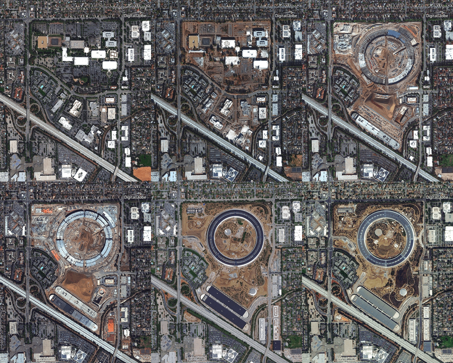
 Time lapse showing the construction of the Apple Headquarters in Cupertino, California.[/caption]
A construction focus
Many industries have a use for satellite imagery. After extensive market research, Bird.i became one of the first companies focused on providing satellite imagery to the AEC industry. Bird.i has now taken on the challenge of educating the construction market about the power and possibilities of up-to-date satellite imagery:- As the construction market booms worldwide and DigitalGlobe collects satellite imagery around the globe, we can monitor and serve a wide variety of geographical markets.
- Construction sites can easily be identified, viewed and analyzed with the satellite imagery pulled into our system. Industry-leading 30 cm resolution satellite imagery can give companies a clear view of the site and associated assets, such as cranes, vehicles, materials and access points.
- The development time of these large real estate or infrastructure projects is typically between two to four years, making progress easily trackable from space with a weekly, monthly or quarterly satellite revisit rate.
Benefits for the AEC markets
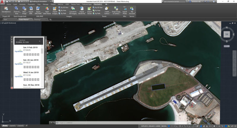
It can be cost-prohibitive for some AEC companies to purchase recent satellite imagery of their construction sites. Bird.i has found many AEC companies would either task expensive drone flights or resort to free alternatives, such as Google Earth, to serve their needs. Free sources of imagery are often not precise enough for business use as the imagery is outdated and low resolution. In construction, using this free data or not having the technical skills to process paid-for imagery could lead to design errors, additional revisions, delays and inevitable rising costs. This is where Bird.i wants to disrupt the market and simplify the consumption process. Our latest partnership with Plexscape, developers of Plex.Earth, one of the most popular tools for AutoCAD, will accelerate the adoption of up-to-date DigitalGlobe satellite imagery by the AEC industry. Giving the AEC industry access to recent imagery will provide greater context to the design process, strengthening proposals and reducing error along the construction cycle. [caption id="" align="aligncenter" width="800"] AutoCAD with DigitalGlobe imagery displayed in Plex.Earth.[/caption]
The latest satellite imagery can benefit several stages of the construction process, equipping key stakeholders with a valuable data source to inform planning and decision-making. Real estate developers use it when searching or evaluating a site; engineers and architects use the imagery to give their designs an up-to-date geographical context; and project managers consult images over time to monitor the build process.
[caption id="" align="aligncenter" width="800"]
 DigitalGlobe imagery of the Dubai Marina shown in AutoCAD thanks to the partnership between Bird.i and PlexEarth.[/caption]