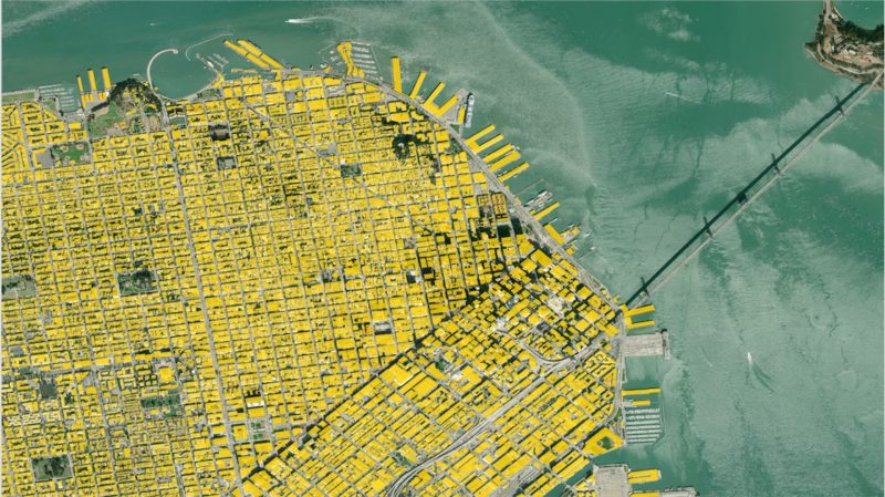
Almost a year ago, we posted about a budding partnership with Ecopia Tech Corporation (“Ecopia.ai”). Today, I am excited to announce a major milestone in our partnership with Ecopia.ai: together we have completed the extraction of every building footprint across the entire United States.
Coast to coast, Ecopia.ai’s algorithm has scoured Maxar’s country-wide imagery database and extracted every visible building to create the first complete dataset of its kind, capturing every structure (greater than 100 sq ft) in the U.S. And we’re not talking about generic blobs. We are talking more than 169 million precise (>95% valid interpretation) footprints across every state!
So how did we get to this point, and why? Maxar has been expanding its cloud-based Geospatial Big Data platform (GBDX), working closely with ecosystem partners to build AI-based technology to extract and create insights from our imagery. Ecopia.ai, an ecosystem partner, has directed their focus on developing a building footprints product. Because building footprint vector polygons are a core data point in geospatial analysis, and production processes to date have been so clunky, there was considerable value in developing a semi-automated technology to build out this dataset. This technology, and the wealth of rich data derived from it, was instrumental in helping make PSMA’s vision a reality (Quantifying the entire built environment of Australia). This accomplishment inspired a new project: extracting the entire U.S.
Of course, it doesn’t stop there. Ecopia.ai’s impressive algorithm can be applied to any image from Maxar’s global image library. Am I saying building footprints from any location on Earth can be extracted with the same high accuracy, completeness, quality, and scale? Yes, yes I am. The brilliant minds at Ecopia.ai have been developing their building footprint detection algorithm for more than five years - feeding the machine learning monster millions and millions of training samples and running countless hours of QC to optimize the outputted results. The result is a building footprint machine that has no geographical limitations.
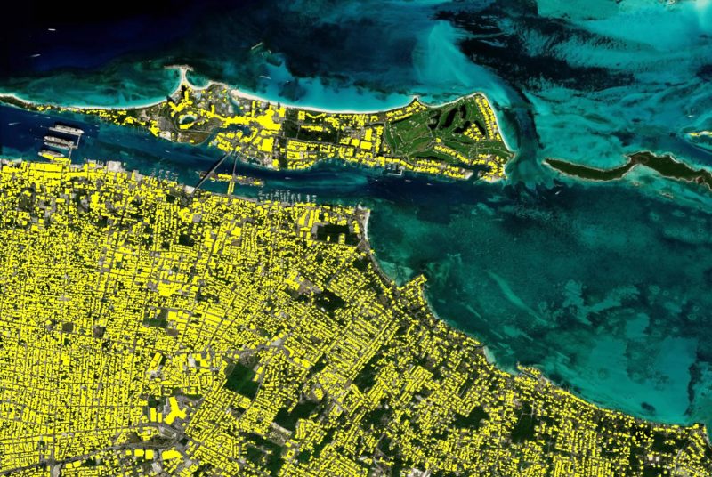
We are not only extracting footprints for the U.S. but also producing on-demand international footprints concurrently. With an output of 40 million footprints per month, Ecopia.ai is producing over 900 footprints per minute! These numbers truly demonstrate the power and value of cloud-based access to all 100 petabytes (and counting) of Maxar imagery.
But what’s really impressive is what this means for analysts and organizations trying to answer a myriad of complex questions about our changing planet. Building footprint data are often a foundational element for informing geospatial decisions (i.e. emergency planning and response, asset management, population mapping, etc.), but traditional sources are outdated and the means of generating them is extremely tedious. This has left organizations to settle with an additional layer of uncertainty in their decision making.
We’re poised to help remove that uncertainty while getting to those decisions faster. Semi-automated footprint extraction combines the best of artificial intelligence and human analysis for consistent, geometrically accurate outlines produced at a scale never before possible.