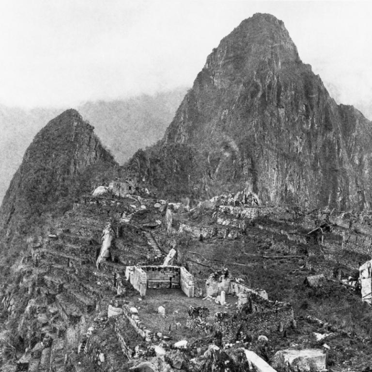
 PHOTOGRAPH BY HIRAM BINGHAM, NATIONAL GEOGRAPHIC[/caption]
[caption id="attachment_5143" align="aligncenter" width="700"]
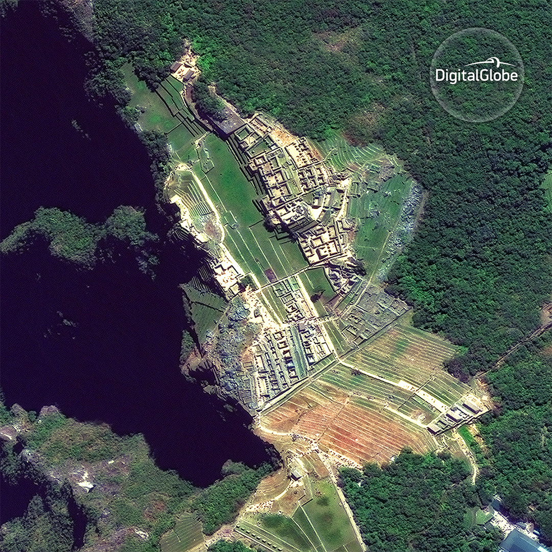
 IMAGE © 2016 DIGITALGLOBE[/caption]
Satellite images have the unique ability to view immense swaths of Earth and see color combinations not visible to the human eye, therefore revealing more information about what’s there. They can also snap images of places on Earth that are dangerous--or impossible--to travel to in person. Satellite images provide a high-level perspective of Earth and its inhabitants that can’t be achieved by traditional photos taken by the snap of a finger.
In January, the GlobalXplorer project is launching its inaugural online expedition in Peru. The project will make high-resolution satellite images available on its website and invite volunteer explorers to search through them, looking for signs of looting and encroachment of known historically significant areas--as well as looking for signs of sites not known to modern archaeologists.
Just as Hiram’s photos of Machu Picchu spurred greater curiosity, research, funding, and resources for the discovery and preservation of archaeological sites at the turn of the 20th century, we hope to achieve the same with GlobalXplorer, but on a massively larger scale. Hiram identified and photographed several sites during that expedition to Peru that took five years. With the use of high-resolution satellite imagery and special image processing techniques, we can potentially canvass over 200,000 square kilometers in a matter of weeks and mark areas of interest for follow-up by a team of professional archaeologists working with local Peruvian government and non-government cultural authorities.
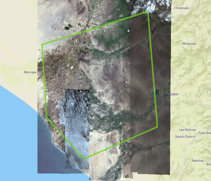
Using the right imagery is key for GlobalXplorer’s success. First, we need to know where to look. For example, we need to use imagery that shows the topical features of the ground (e.g. analyzing imagery of Peru’s dense rainforests won’t work, because we can’t see through the thick tree canopies down to the ground). Dr. Sarah Parcak’s GlobalXplorer team of archaeologists uses historical and scientific information in order to pinpoint unique areas of interest (AOIs), which they convert into geospatially readable formats, such as an ESRI shapefile or GeoJSON. With each AOI, they perform an image search in DigitalGlobe’s archive of satellite images.
[caption id="attachment_5145" align="aligncenter" width="700"]
 Initial results from an archive image search for a Peru area of interest (AOI).[/caption]
But not all images are created equal. Some images are higher resolution than others, some contain cloud cover which obstructs our view to the ground, some are taken at an angle with a “sideways” appearance, and others are older than we would prefer to use for the online expedition. The terms we use to classify and sort the images are:
- Resolution: Depending on which sensor (aka satellite) we use, we can get different resolution images. For the GlobalXplorer project, we are prioritizing 30-50 cm resolution imagery in order to see as much detail on the ground as possible.
- Cloud cover: This is generally calculated as the total percentage of each image covered by dense clouds, and the number is stored in the image’s metadata. For the GlobalXplorer project, we are prioritizing images with less than 15% cloud cover.
- Nadir Angle: This is the angle (in degrees) from which the satellite takes an image of the surface of the Earth. An image taken directly over a location is at 0 degrees nadir. The image will appear to be taken from directly overhead (you won’t see the sides of buildings or trees). Any image taken not perpendicular to the Earth’s surface is designated a certain degree of off-nadir. For the GlobalXplorer project, we are aiming to use images that are 15 degrees off-nadir or less.
- Currency: This refers to the time the image was taken from the preferred date of the investigation. For the GlobalXplorer project, we want to use the most recent images for looting and encroachment monitoring, but it’s acceptable to use images that are several years older for new site discovery.
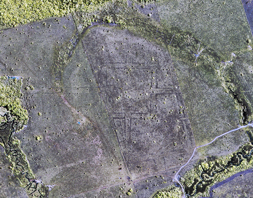
 This false color satellite image is an example of how imagery can be manipulated to show us things (i.e. vegetation health) that aren't naturally visible to the human eye.[/caption]
The fact that more than 100 years later, Hiram Bingham’s images appear in a Google image search of Machu Picchu is a testament to the power and lasting impact of an image. By using satellite imagery in the GlobalXplorer project, we hope to preserve known historical sites, discover new ones, and in the process create new iconic images that will stand the test of time and help tell our shared human story.