Stereophotogrammetry is the process of creating 3D models using two images of the same area taken from known differentiated angles, it’s the same process our eyes use to see things in 3D. Just 2 years ago, If anyone had bet me that space-borne photogrammetry could produce elevation models detailed enough to see individual air conditioners on the roofs of buildings, I would have gladly put my money on “no way.” But today, the combination of our 30 cm high resolution satellite imagery and new advances in photogrammetry is allowing for levels of detail in 3D models that previously only airborne sensors could provide. Multi-view photogrammetry and correlator algorithms like semi-global matching have opened the door for a new revolution in the remote sensing marketplace.Wide area digital elevation models (DEMs) – and even global DEMs – have been around for a while. Since the release of the Shuttle radar topographic mission DEM in 2003, many new markets for elevation have opened that were not part of the traditional project-based elevation market. These markets proliferated because of the free availability of the low-resolution data. But as these new markets have expanded and grow ever competitive, the need for higher resolution at low cost has grown steadily. We are currently looking at the crest of a third wave in the elevation market: high-resolution, wide-area DEMs at affordable pricing is the new frontier. Products like WorldDEM from the German Aerospace Center (DLR) and AW3D from Japan Aerospace Exploration Agency (JAXA) (along with industry partners NTT Data and RESTEC) have lead the way into this new market with 12-meter and 5-meter resolutions, respectively. But it’s Vricon, a joint venture of Maxar and Saab, who is the first vendor to look at the possibility of providing global coverage at stunning a 50 cm resolution – blurring the lines between the traditional GIS consumers and the new wide-area DEM users.
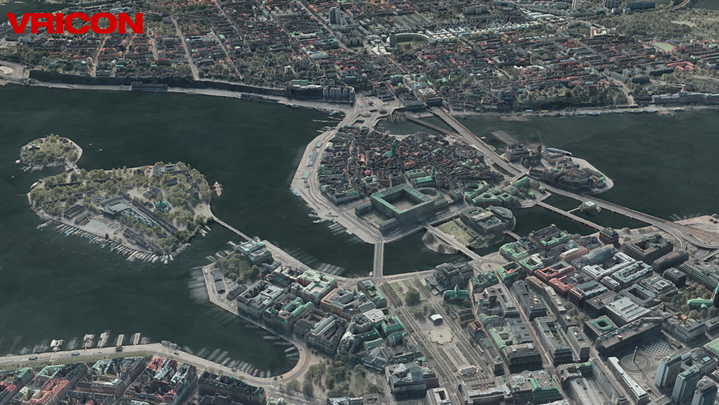
This level of detail at a global scale is only possible thanks to Maxar's massive data library. Our archive contains nearly 90 petabytes of image data -- enough images to cover the earth more than 40 times. This deep stack of images makes possible the complex geometries required for multi-view photogrammetry and ensures that high resolution DEMs can be produced rapidly for most locations on Earth. The remote sensing industry has never been able to achieve this combination of outstanding quality, global reach, and swift production until now.To many veterans of the elevation market, this concept of off-the-shelf 50 cm global DEMs seems like a far off fairy tale. But as Vricon has ramped their production levels to nearly 2 million square kilometers per month with country-wide deliveries already on the shelf, we are seeing that global high-res data is a reality. We believe it will change the elevation market forever. See for yourself. Download a digital elevation model sample.