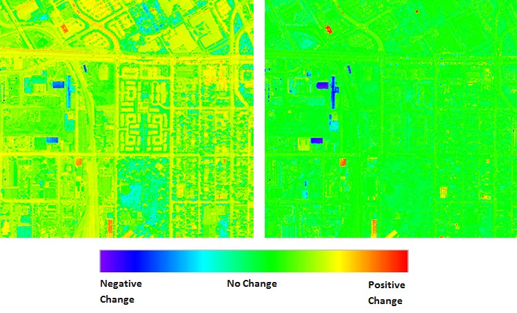
 When a change detection algorithm is run against the original, uncorrected images, it produces the output shown below on the left. This result incorrectly implies that there have been many changes, as indicated by the heat map. After AComp is applied, however, the result on the right provides a much more accurate assessment of where structures have been built up or torn down — dramatically reducing the amount of manual interpretation required to produce a decision-ready result.
 AComp is just one of many technologies DigitalGlobe has developed to optimize our imagery for different customer needs. For example, our Location-Based Services customers like Mapbox require a basemap that’s optimized for global consistency. With our Basemap +Vivid and +Metro products, our sophisticated algorithms identify the best images from our massive imagery library. Then, for country-scale products, these algorithms adjust for aspects like contrast and tone to transform a patchwork quilt of image strips taken by multiple sensors during different seasons and times of day into a mosaic product with unrivaled consistency, completeness, and visual appeal.
These are just a few of the innovations that DigitalGlobe has pioneered over the last two decades that have allowed us to become a trusted partner of many of the world’s largest and most sophisticated users of satellite imagery and geospatial intelligence. With a 15-year time-lapse image library, a global ground infrastructure, and powerful machine learning and cloud computing technologies, DigitalGlobe is extending its industry leadership position and delivering even more powerful and insightful solutions for our customers.