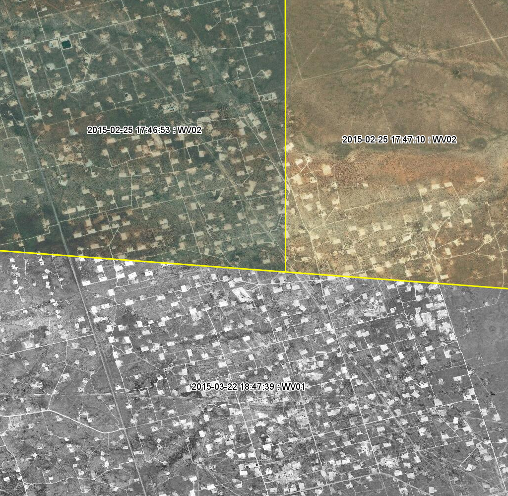
 Permian Basin - March 22, 2015 - WorldView-1. DigitalGlobe's professional grade basemap includes the most recent imagery available and true metadata that overlays the image, so you know exactly when it was collected, by what sensor and at what accuracy.[/caption]
You’re visiting a new city on a business trip, and you have a craving for a nice, big, Bavarian crème-filled donut. But where to find it? Easy, just break out the old smartphone, hit “Maps” and it will show you the closest place to satisfy your hunger.
After you finish your donut, you have to drive a few hours to the remote site where your company is going to drill five new gas wells. It’s hilly, tree-laden, and there may not be enough roads to bring in all the logistical equipment your company will need to begin operations. What to do? Again, easy. Just break out the map app from your smartphone to see what the surrounding terrain looks like.
But wait, the road you are driving on isn’t even there. And the satellite picture of the area is so low-res that you’re not sure if that dark stuff is a bunch of trees or a family of bears.
And therein lies the problem with using the wrong kind of basemap for your business.
What gets you to the donut shop is probably not what you want to get you to your multi-million dollar project.
There are basically two types of basemaps, consumer-grade and professional-grade. The consumer maps do indeed show satellite images of most areas, but their revenue is derived from advertising, and therefore remote areas which aren’t heavily travelled, and which do not have any retail presence, doesn’t equate to dollars for them. So as a result, images of those areas may only be refreshed every five or 10 years, and most times, are of a much lower resolution than professional-grade basemaps.
Professional-grade imagery basemaps, such as the ones offered by DigitalGlobe, not only are created using some of the highest resolutions available, but they are updated and refreshed sometimes as often as several times a day. If your business needs to know how to get drilling rigs, fracking water trucks, pipes, rigging, and trailers in and out of a remote region, you need fresh, accurate, and reliable readable data. That is the primary advantage of professional-grade basemaps.
Another advantage is the metadata that supports the imagery on the map. The metadata can include everything from alignment information, exact latitude and longitude, time of day, weather conditions, and positional accuracy.
Having the correct satellite imagery basemap in the planning stages before you begin your operations will also reduce costs by not having to conduct many rounds of ground-level surveillance and reconnaissance. This is extremely critical when planning and making decisions for high-value projects, not only from the monetary standpoint, but from a safety one as well. Especially in the oil and gas industry, where safety is paramount.
There are many other factors in choosing the right basemap. All of the criteria that goes into making the right decision will be discussed in DigitalGlobe’s upcoming webinar, “Basemaps 101.”
The free webinar will be on Thursday, August 27 at 10 a.m. CDT (8 a.m. PDT, 11 a.m. EST). Register now!
Of course, there won’t be donuts, but you have an app for that.
Jeff Miller is a seasoned marketing communications professional focused on the oil & gas industry.
Permian Basin - March 22, 2015 - WorldView-1. DigitalGlobe's professional grade basemap includes the most recent imagery available and true metadata that overlays the image, so you know exactly when it was collected, by what sensor and at what accuracy.[/caption]
You’re visiting a new city on a business trip, and you have a craving for a nice, big, Bavarian crème-filled donut. But where to find it? Easy, just break out the old smartphone, hit “Maps” and it will show you the closest place to satisfy your hunger.
After you finish your donut, you have to drive a few hours to the remote site where your company is going to drill five new gas wells. It’s hilly, tree-laden, and there may not be enough roads to bring in all the logistical equipment your company will need to begin operations. What to do? Again, easy. Just break out the map app from your smartphone to see what the surrounding terrain looks like.
But wait, the road you are driving on isn’t even there. And the satellite picture of the area is so low-res that you’re not sure if that dark stuff is a bunch of trees or a family of bears.
And therein lies the problem with using the wrong kind of basemap for your business.
What gets you to the donut shop is probably not what you want to get you to your multi-million dollar project.
There are basically two types of basemaps, consumer-grade and professional-grade. The consumer maps do indeed show satellite images of most areas, but their revenue is derived from advertising, and therefore remote areas which aren’t heavily travelled, and which do not have any retail presence, doesn’t equate to dollars for them. So as a result, images of those areas may only be refreshed every five or 10 years, and most times, are of a much lower resolution than professional-grade basemaps.
Professional-grade imagery basemaps, such as the ones offered by DigitalGlobe, not only are created using some of the highest resolutions available, but they are updated and refreshed sometimes as often as several times a day. If your business needs to know how to get drilling rigs, fracking water trucks, pipes, rigging, and trailers in and out of a remote region, you need fresh, accurate, and reliable readable data. That is the primary advantage of professional-grade basemaps.
Another advantage is the metadata that supports the imagery on the map. The metadata can include everything from alignment information, exact latitude and longitude, time of day, weather conditions, and positional accuracy.
Having the correct satellite imagery basemap in the planning stages before you begin your operations will also reduce costs by not having to conduct many rounds of ground-level surveillance and reconnaissance. This is extremely critical when planning and making decisions for high-value projects, not only from the monetary standpoint, but from a safety one as well. Especially in the oil and gas industry, where safety is paramount.
There are many other factors in choosing the right basemap. All of the criteria that goes into making the right decision will be discussed in DigitalGlobe’s upcoming webinar, “Basemaps 101.”
The free webinar will be on Thursday, August 27 at 10 a.m. CDT (8 a.m. PDT, 11 a.m. EST). Register now!
Of course, there won’t be donuts, but you have an app for that.
Jeff Miller is a seasoned marketing communications professional focused on the oil & gas industry.