Tropical Storm Barry is gaining strength in the northern Gulf of Mexico with winds up to 40 mph currently. The tropical storm has a good chance of becoming a weak hurricane with winds forecast to possibly reach around 75 mph by Saturday. Shortly after that happens, there is a high likelihood of the system making landfall along the Louisiana coast. Winds, however, will not be the major impact from this system - moreso heavy rain.
“Flooding rains could be the main story from this system as it heads toward Louisiana with some locations closing in on 15-inch totals through early next week,” said Bradley Harvey, Maxar’s Weather Desk Meteorologist.
Most oil and gas companies have already evacuated employees off drilling rigs and platforms in the northern Gulf of Mexico in anticipation of the system strengthening. According to Maxar’s Weather Desk, the projected path of the tropical system bears down on Louisiana and cuts right through the highest concentration of platforms. Refinery operations along coastal areas will be impacted as well.
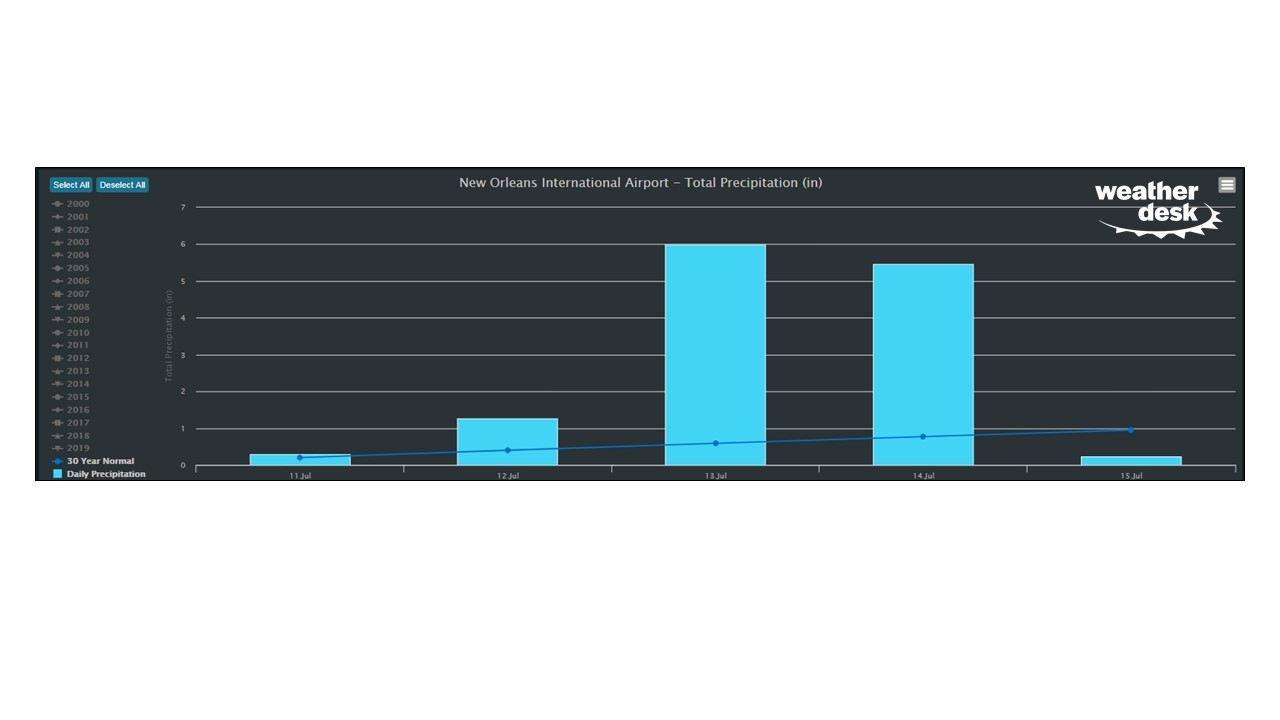
Several inches of rain already fell in New Orleans the last few days and any additional rainfall could cause some serious problems in the metropolitan area.
“We are forecasting rainfall storm totals around 13 inches specifically for New Orleans and will be monitoring the situation over the weekend,” said Harvey.
As the tropical system comes onshore over the weekend, isolated tornadoes cannot be ruled out either. The governor of Louisiana already has declared a state of emergency in anticipation of Tropical Storm Barry’s impacts.
Maxar’s WeatherDesk provides access to timely and accurate weather data that empowers decision making and mitigates risk. Special weather reports focus on key market-moving concerns and 24/7/365 consultation is available for clients worldwide.

WeatherDesk Customer Inquiries
Chris Hyde
Maxar WeatherDesk
1-240-833-8322
christopher.hyde@maxar.com