Historic flooding occurred across portions of the western Midwest earlier this month, including major corn and soybean production regions.
“Rapid snowmelt accompanied by heavy rainfall led to extreme flooding in portions of eastern Nebraska and western Iowa earlier this month, with river levels exceeding all-time records in several areas.” said Kyle Tapley, Senior Agricultural Meteorologist for Maxar.
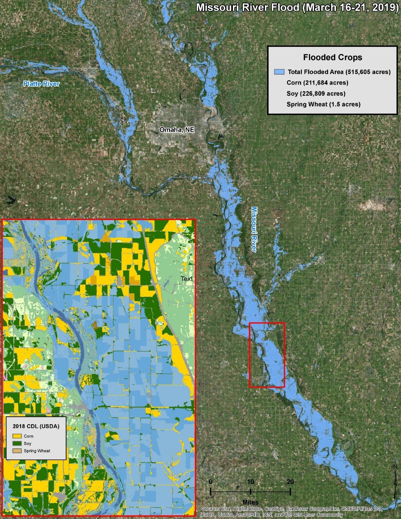
With spring planting season approaching, Maxar used Sentinel-2 imagery and the 2018 USDA/NASS Cropland Data Layer to analyze how much potential corn and soybean acreage was inundated by flooding.
“We estimate that more than 400,000 acres that produced corn and soybeans last year were inundated during this flooding event.” said Jorge Cardona, Senior Imagery Analyst for Maxar.
More than 500,000 acres of land was flooded in total, including 211,684 acres where corn was grown in 2018 and 226,809 acres where soybeans were grown in 2018. While floodwaters are now receding in eastern Nebraska and western Iowa, river levels are increasing across the northern Plains, with more flooding likely.
“Major flooding is inevitable in the coming weeks as a deep snowpack continues to melt across the Red River Valley, an important corn, soybean, and spring wheat growing area.” said Mr. Tapley.
Maxar will continue to use its combined expertise in weather, remote sensing, and agriculture to track the ongoing flooding across the central U.S. and its impact on agriculture.
Maxar’s WeatherDesk provides access to timely and accurate weather data that empowers decision making and mitigates risk. Special weather reports focus on key market-moving concerns and 24/7/365 consultation is available for clients worldwide.
For more information, please contact:
Chris Hyde
Radiant Solutions
240-833-8322
chris.hyde@radiantsolutions.com