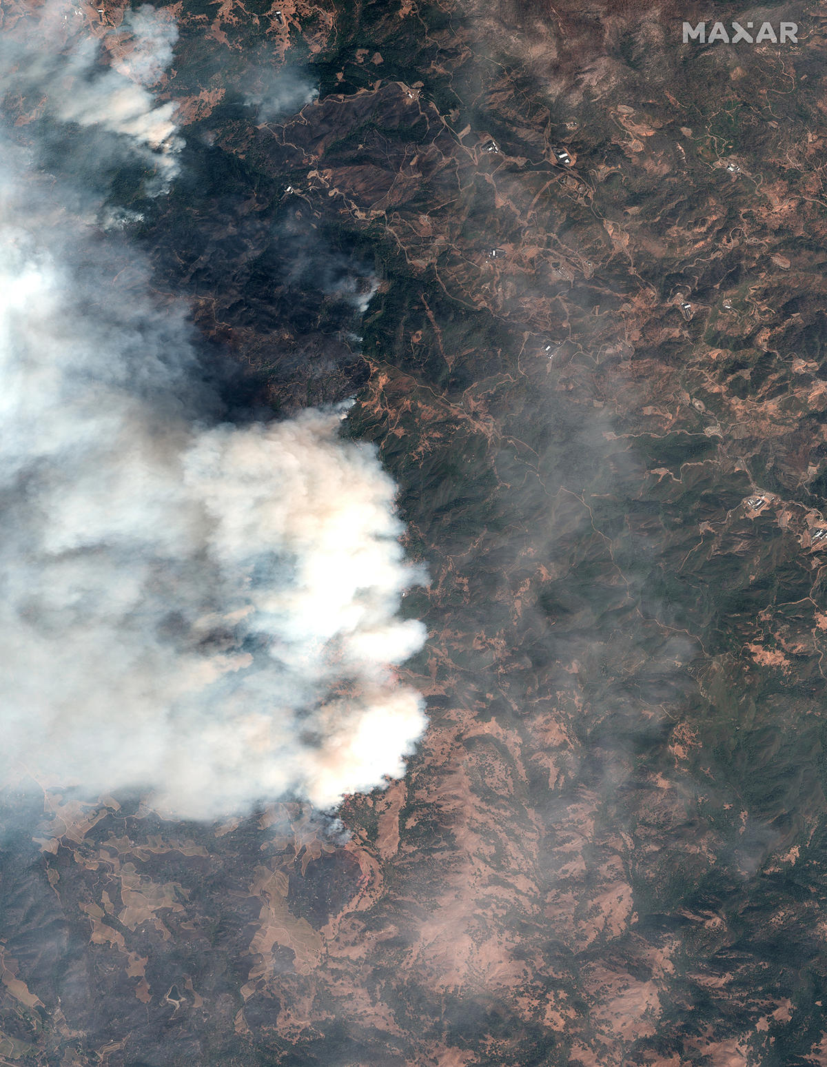
California’s Kincade Fire has scorched more than 76,000 acres and is only 30 percent contained as it continues its destructive path across Sonoma County. Red flag warnings have been issued with wind gusts hitting 50-55 miles per hour on peaks in the North Bay. Approximately 156,000 people remain under evacuation orders, with the possibility of some evacuations being lifted by the end of the day Wednesday, October 30th. The fire has destroyed 206 buildings, half of which were homes, and more than 90,000 structures are being threatened.
Get the latest updates on incidents in California from the California Department of Forestry & Fire Protection.
When crises like this occur, Maxar is committed to supporting the humanitarian community by providing critical and actionable information to assist response efforts and fulfilling our purpose, For a Better World. As part of our Open Data Program, Maxar will publicly release data of the affected areas to support disaster response as it becomes available.
Any imagery or data distributed through the Open Data Program is licensed under the Creative Commons Attribution Non-Commercial 4.0 license (CC BY-NC 4.0). This licensing allows for non-commercial use of the information, meaning it can quickly be integrated into first responder workflows with organizations like Team Rubicon, the Red Cross and other non-profits. If commercial companies are interested in using the data distributed through the Open Data Program, it can be purchased by contacting us here.
Pre-event imagery has been posted on our Open Data Program website. Please continue to check this site and our social media channels for updates on post-event data.