Think back 20 years… a Nokia cell phone with the ‘snake’ game was the newest tech gadget to own, MapQuest was the primary online map service available and people were worried about Y2K and its effect on our technology infrastructure.
On September 24, 1999, the technology world changed with a satellite launch. The first high-resolution commercial imaging satellite to begin operations, IKONOS, launched from Vandenberg Air Force Base in California. This satellite provided the public with the first detailed images of Earth from space; previously, only governments owned and operated imaging satellites.

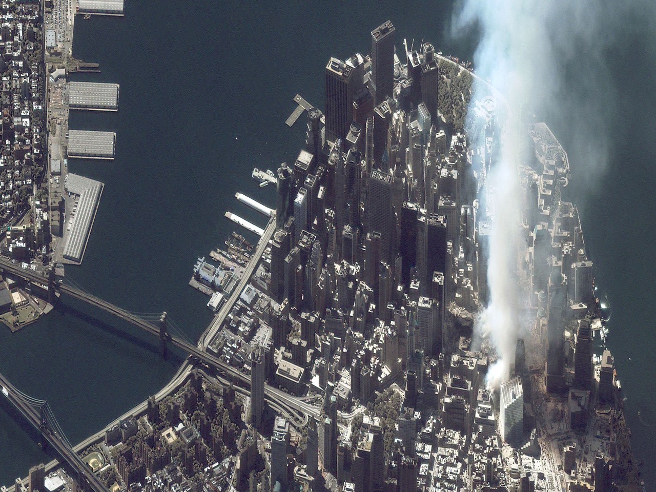
The insight provided by IKONOS impacted peoples’ everyday lives, whether they realize it or not. People saw their homes from space for the first time using IKONOS imagery through Google Maps or Google Earth. First responders observed from space terrorist attacks like those on the World Trade Center and the Pentagon, and disasters like the Fukushima earthquake, tsunami and nuclear meltdown– at a distance from which human lives would not be further threatened but first responders could learn about the situation on the ground.
IKONOS ended its mission in 2015, after serving our customers dutifully for 15 years. The satellite collected 154 million square kilometers of imagery, which is still available in Maxar’s public archive, serving as an important baseline for humanity’s understanding of our changing planet.
Today, high-resolution commercial satellites continue to influence lives on a daily basis. Maxar satellite imagery is a foundational data source to most of the online mapping platforms available, provides a key data source for autonomous vehicle safety and informs mission-planning decisions by the U.S. government and its allies.
On the 20th anniversary of the launch of IKONOS, we asked some of the people involved with the satellite to look back on how IKONOS and the commercial satellite imagery industry changed the world:
Mike Martinez, Maxar VP of Space Engineering, sent the first and last signals to the IKONOS satellite. He talks about what it was like to work with IKONOS.
To learn more about the IKONOS satellite, explore our interactive timeline of its life and milestones.