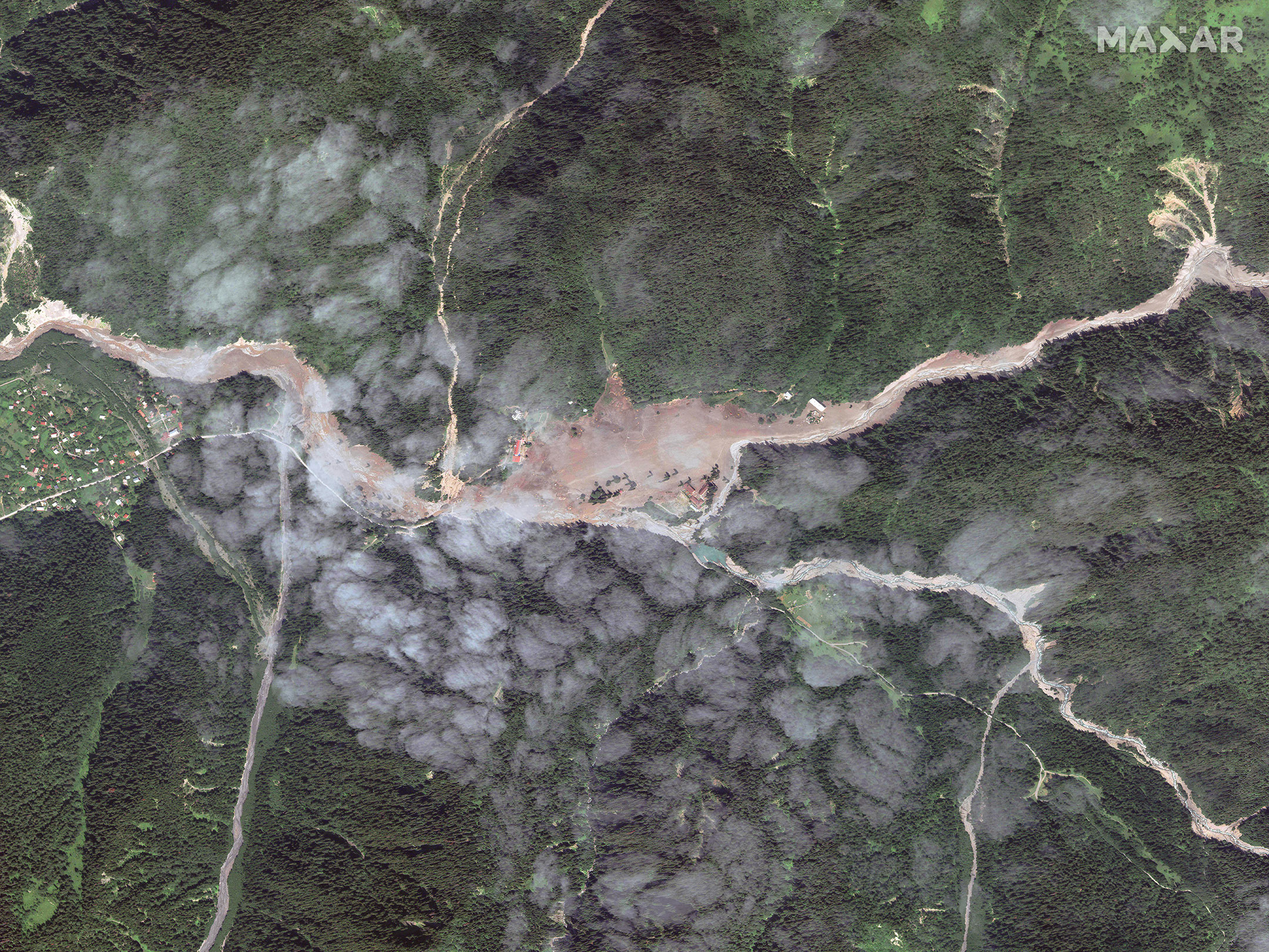
A landslide on August 3 in the mountain resort town of Shovi in Georgia has killed up to 19 people as of Tuesday, August 9 and dozens more are missing. More than 200 people were evacuated from the area, located at the confluence of two rivers. Drone footage showed mud, trees and other debris covering the town. A geologist from Georgia’s National Environmental Agency said the landslide was caused by heavy rainfall and intensified melting of two glaciers into the at the headwaters of the river.
Learn more about the Shovi landslide in these news articles:
When crises occur, Maxar is committed to supporting the humanitarian community by providing critical and actionable information to assist response efforts and fulfill our purpose, For A Better World. As part of our Open Data Program, Maxar will publicly release data of the affected areas to support response efforts as it becomes available.
Any imagery or data distributed through the Open Data Program is licensed under the Creative Commons Attribution Non-Commercial 4.0 license (CC BY-NC 4.0). This licensing allows for noncommercial use of the information, meaning it can quickly be integrated into first responder workflows with organizations like Team Rubicon, the Red Cross and other nonprofits. If commercial companies are interested in using the data distributed through the Open Data Program, it can be purchased by contacting us here.
Imagery has been posted on our Open Data Program website. Please continue to check this site and our social media channels for updates on additional post-event data.

Satellite image of Shovi, Georgia taken on August 8, 2023.