A devastating magnitude 7.8 earthquake struck the Turkish province of Kahramanmaras, approximately 23 kilometers east of Nurdagi in the Gaziantep province near the Syrian border, at 4:17 a.m. local time on Monday, February 6, 2023, followed by a 7.5 magnitude aftershock nine hours later.
More than 6,000 people have died in Turkey and Syria, and tens of thousands of people have been injured. Those numbers are expected to increase as search and rescue activities continue. At least 13 million people in the region have been impacted by the earthquake and aftershock. Turkey’s president declared a three-month state of emergency in the 10 provinces hardest hit by the earthquake.
Learn more about the earthquake in these news articles:
When crises occur, Maxar is committed to supporting the humanitarian community by providing critical and actionable information to assist response efforts and fulfill our purpose, For A Better World. As part of our Open Data Program, Maxar will publicly release data of the affected areas to support response efforts as it becomes available.
Any imagery or data distributed through the Open Data Program is licensed under the Creative Commons Attribution Non-Commercial 4.0 license (CC BY-NC 4.0). This licensing allows for noncommercial use of the information, meaning it can quickly be integrated into first responder workflows with organizations like Team Rubicon, the Red Cross and other nonprofits. If commercial companies are interested in using the data distributed through the Open Data Program, it can be purchased by contacting us here.
Imagery has been posted on our Open Data Program website. Please continue to check this site and our social media channels for updates on additional post-event data.
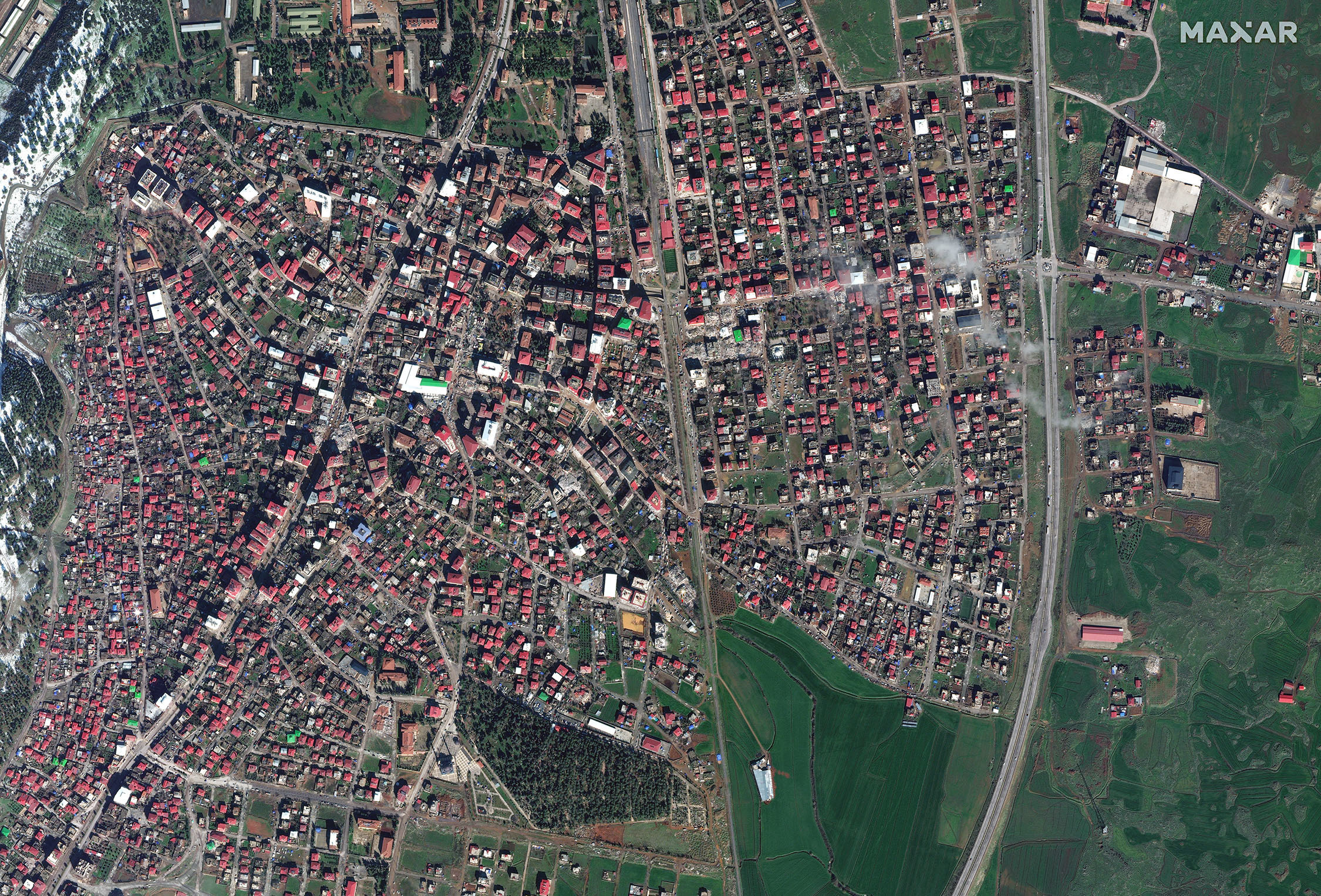
Maxar satellite image of Islahiye, Turkey from February 7, 2023.