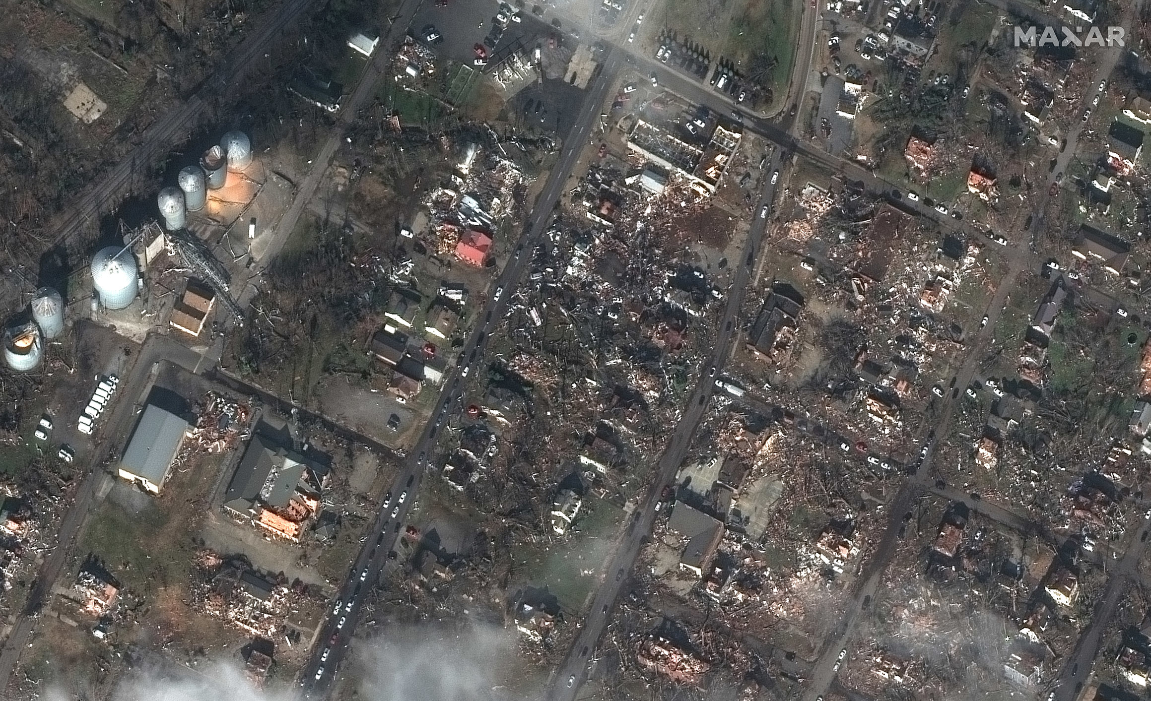
Severe weather in the South and Midwest regions of the U.S. caused multiple tornadoes late Friday, December 11, into early Saturday, December 12, 2021. The tornadoes tore through Kentucky, Illinois, Indiana, Mississippi, Missouri, Ohio, Tennessee and Arkansas, killing at least 100 people. One of the hardest hit areas was Mayfield, Kentucky, where a candle factory was severely damaged. More than 100 tornado warnings were issued Friday before midnight, the most warnings ever for any day in December. One storm cell was tracked on radar for approximately four hours through parts of four states and for more than 250 miles; it could end up being the longest continuous tornado in history once verified.
Learn more about this event in the following news articles.
- https://www.npr.org/2021/12/11/1063335433/dozens-are-feared-dead-as-tornadoes-hit-midwestern-and-southern-u-s
- https://www.cnn.com/2021/12/13/weather/deadly-tornadoes-wxc-trnd/index.html
When crises like this occur, Maxar is committed to supporting the humanitarian community by providing critical and actionable information to assist response efforts and fulfilling our purpose, For A Better World. As part of our Open Data Program, Maxar will publicly release data of the affected areas to support response efforts as it becomes available.
Any imagery or data distributed through the Open Data Program is licensed under the Creative Commons Attribution Non-Commercial 4.0 license (CC BY-NC 4.0). This licensing allows for noncommercial use of the information, meaning it can quickly be integrated into first responder workflows with organizations like Team Rubicon, the Red Cross and other nonprofits. If commercial companies are interested in using the data distributed through the Open Data Program, it can be purchased by contacting us here.
Imagery has been posted on our Open Data Program website. Please continue to check this site and our social media channels for updates on additional post-event data.
Severe tornado damage in Mayfield, Kentucky, as seen in these before and after satellite images.

