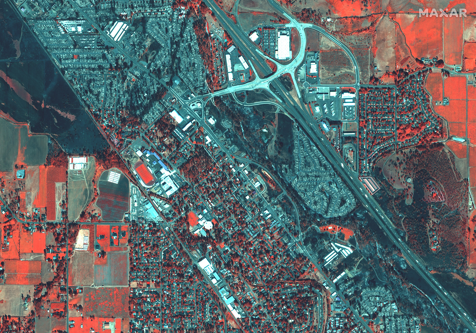
The prospect of scattered rain in the Pacific Northwest raised hopes for better firefighting conditions in Washington and Oregon as of Wednesday, September 16, after weeks of oppressive heat, hazardous air and unpredictable fires that have grown with terrifying speed up and down the coast. Though the storm system was not forecast to be significant, the possibility of rain clouds in coastal regions, instead of smoke plumes and falling ash, was a lifeline for residents after weeks of increasingly grim news. More than 30 people have died in wildfires in the past two months, hundreds of homes have been destroyed, and thousands of people remain in evacuation shelters. Inland and to the south, the forecast was less encouraging. Parts of Central Oregon were expecting gusts up to 35 miles per hour in the afternoon that could contribute to a “significant spread” of new and existing fires, the National Weather Service in Medford, Ore., said. Up to 29 fires were active in Oregon on Wednesday, spread over more than 843,500 acres. Washington State’s Governor Inslee said that they are in a much better position and could possibly be able to help its neighbors by sharing some of its resources with Oregon.
On August 25, 2020 we activated our Open Data Program for wildfires in California and Colorado. We will continue to update that activation. Check here for any updates.
When crises like this occur, Maxar is committed to supporting the humanitarian community by providing critical and actionable information to assist response efforts and fulfilling our purpose, For a Better World. As part of our Open Data Program, Maxar will publicly release data of the affected areas to support response efforts as it becomes available.
Any imagery or data distributed through the Open Data Program is licensed under the Creative Commons Attribution Non-Commercial 4.0 license (CC BY-NC 4.0). This licensing allows for non-commercial use of the information, meaning it can quickly be integrated into first responder workflows with organizations like Team Rubicon, the Red Cross and other nonprofits. If commercial companies are interested in using the data distributed through the Open Data Program, it can be purchased by contacting us here.
Imagery has been posted on our Open Data Program website. Please continue to check this site and our social media channels for updates on additional post-event data.

WorldView-3 SWIR satellite image of Phoenix, Oregon after the Alameda Fire take on September 9, 2020.