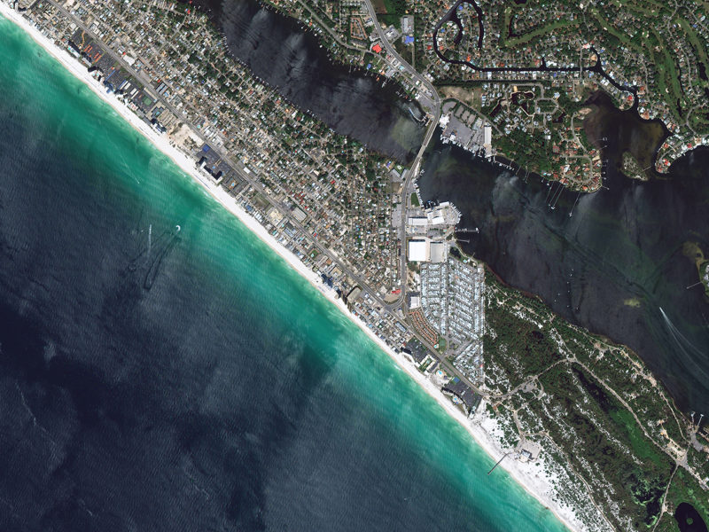
Hurricane Michael made landfall along Florida’s northeastern Gulf Coast the afternoon of Wednesday, October 10th. This storm has been called the most powerful hurricane to hit the U.S. mainland in nearly 50 years, as it slammed into the Florida Panhandle as a Category 4 hurricane. Life-threatening storm surge and winds up to 155 mph caused devastation in places like Panama City and Mexico Beach, Florida. As of Thursday, October 11th, almost 1 million people were without power in Florida, Georgia, Alabama and the Carolinas. Inland areas from Georgia up to Virginia could see up to 8 inches of heavy rain.
DigitalGlobe's interactive map shows the predicted buildings at risk of flooding from Hurricane Michael’s storm surge along the Florida coastline from Pensacola to just north of Tampa. DigitalGlobe used its GBDX Notebooks product to intersect the Ecopia U.S. Building Footprints powered by DigitalGlobe with NOAA’s Public Advisory #16 storm surge prediction (from 11 a.m. ET on10/10/18 – right before landfall) to identify and attribute each building with the predicted depth of storm surge.
Ecopia U.S. Building Footprints powered by DigitalGlobe are the first high-precision, GIS-ready building footprints dataset of the entire United States. They are created using Ecopia Tech Corporation’s proprietary artificial intelligence algorithms combined with DigitalGlobe’s current, high-resolution commercial satellite imagery, resulting in a greater than 95% accuracy rating, a uniquely high percentage in the industry.
When viewing the map at a wide view, you’ll see lots of different colored dots. Each dot represents a building that’s predicted to be impacted by storm surge. The .different colors represent different NOAA predicted storm surge depths (color legend included on the map). As you zoom in to a more specific area, you’ll see the data for each building inside your viewing area.
[caption id="" align="aligncenter" width="800"]

Pre-event image of Panama City Beach, Florida[/caption]
When crises like this occur, DigitalGlobe is committed to supporting the humanitarian community and fulfilling Maxar’s purpose of Building a Better World by providing critical and actionable information to assist response efforts. As part of our Open Data Program, DigitalGlobe will publicly release data of the affected areas to support disaster response as it becomes available.
Any imagery or data distributed through the Open Data Program is licensed under the Creative Commons Attribution Non-Commercial 4.0 license (CC BY-NC 4.0). This licensing allows for non-commercial use of the information, meaning it can quickly be integrated into first responder workflows with organizations like Team Rubicon, the Red Cross and other non-profits. If commercial companies are interested in using the data distributed through the Open Data Program, it can be purchased by contacting DigitalGlobe.
Pre-event imagery has been posted on our Open Data Program website. Please continue to check this site and our social media channels for updates on post-event data.