Editor’s note: Maxar’s Academic Outreach Program has a mission of “inspiring students and faculty by sharing Maxar’s story, fostering the adoption of its technology and advancing collaborative opportunities.” The Program has two groups—a K-12 Committee and a University Committee—staffed by team members who volunteer their time to bring science, technology, engineering and math (STEM) to students.
Maxar partnered with the Spark! Program in St. Louis, Missouri, in fall 2021, to provide high school students in the Parkway School District with two semester-long immersive sessions hosted both in-person and virtually that highlighted geospatial data and software engineering. The program collaborates with industry leaders to design and develop mutually beneficial learning experiences. Maxar led two semester-long immersive sessions that highlighted software engineering.
Introduction to open mapping and foundational geospatial data creation
Maxar’s Foundational GEOINT team members Matt Gibb, Josh Sisskind and Dana Stuckey spent nearly 150 hours developing and teaching a curriculum that incorporated a crash course in geospatial data creation to expose students to the importance of location in their daily lives and potential career opportunities. The session began with an introduction to geospatial data and how it can be created using OpenStreetMap (OSM), a free online map of the world that can be viewed and edited by anyone. Each student created or updated buildings, roads and sidewalks in their own neighborhoods and around the world.
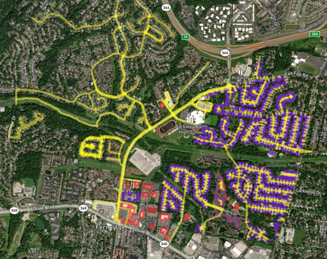
The second half of this class focused on creating a web map using GitHub, an online version control and source code management tool, to collaborate directly with Maxar employees and fellow students. Students created interactive web maps and custom stylesheets (e.g., purple outlines for houses and red outlines for apartments in graphic below) that query and display OpenStreetMap data—including the data they created in OSM. Although Maxar team members led instruction and were available to answer technical questions, the Parkway students were in the driver’s seat for their final projects. At the conclusion of the program, each student presented their work to their peers, highlighting the process of their work, from conception and design, through to the implementation and communication of their work.

Interactive map created by Spark! Program students. Data: OpenStreetMap contributors.
“It’s not often we get the opportunity to give back to the next generation in an interactive way, so we seized this opportunity when it was presented,” said Josh Sisskind, Senior Manager and volunteer mentor from Maxar. “Creating the curriculum for the program reminded me why I got excited to work in the geospatial technology domain in the first place, and I hope that passion and excitement was passed onto these students.”
Learning design thinking and software development

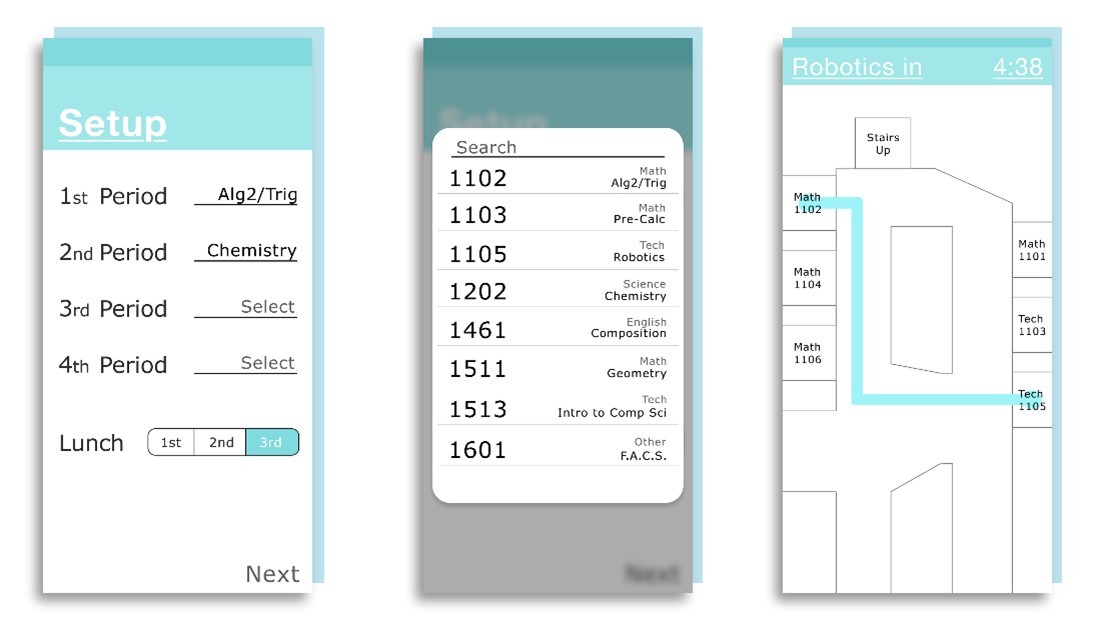
Interactive prototype of the students’ app designed to reduce COVID-19 exposure in their school.
In a second course, Maxar’s innovation-as-a-service shop, xLab, spent 150 hours leading Spark! Program teams through an experience in design thinking and software development to solve a problem of the students’ choice. The students decided to tackle identifying and reducing potential COVID-19 exposure in crowded hallways during passing periods. Maxar’s User Interface/User Experience (UI/UX) Strategy Manager, Brian Helton, guided students through the design thinking process to unearth the challenge and empathize with users to discover insights and pain points. Taking these findings into an iterative approach, the students implemented and tested paper wireframes for an application that would allow users to input their class schedules and then receive recommended routes between classes to avoid high-activity locations. Then, students created interactive prototypes in Adobe XD and worked with xLab software development team members Pedro Sorto, Laura Webb and Jenna Lipscomb to begin implementing their design concepts using the Django framework.
To learn more about the Spark!-Maxar collaboration, join Maxar’s Matt Gibb at the OpenStreetMap community event, State of the Map US 2022. In Matt’s session on Saturday, April 2, 2022, he will share how St. Louis Spark! students were introduced to open mapping.
Join Maxar at State of the Map US 2022
Get the details