Editor’s Note: This blog post is adapted from a keynote speech Tony Frazier gave May 18, 2021, at the GeoConvergence Workshop hosted by the American Geographical Society in support of the National Science Foundation. Click here to view the video of the speech.
The United States is a pioneer in incubating dual-use technology that enables innovation across the public and private sectors. For example, the Global Positioning System (GPS) that began as a U.S. military investment is now embedded into nearly every facet of daily life.
In 2000, the U.S. ended the practice known as Selective Availability, which essentially unscrambled the GPS signal for civilian users globally. A wave of commercial innovation quickly followed. To date, GPS-enabled industries have generated $1.4 trillion in U.S. economic value.
Earth observation from space has followed a similar trajectory. The passage of the Commercial Remote Sensing Act nearly 30 years ago made iconic datasets like NASA’s Landsat available to the public and enabled companies to build, launch and operate high-resolution imaging satellites for dual-use applications.
Today, startup space investment in Earth observation and analytics companies totals $3.3 billion, and constellations of satellites are being built to collect optical imagery, radar data, radio frequency signals and full-motion video. This trend has vastly increased the amount of sensor data humans collect about the Earth as well as the number of methods available to analyze the flood of pixels and reveal actionable insight.
Leading Earth Intelligence
Maxar has leaned into this opportunity and built a leadership position in Earth Intelligence to help customers see, understand and navigate our changing planet. We leverage a common commercial foundation—from sensor to decision—to reveal insight where and when it matters most.
One of the analytic applications Maxar pioneered was creating land cover classification and change detection algorithms to utilize public resources such as Landsat and Europe’s Sentinel-2 to understand trends in urban development and the impact of climate change.
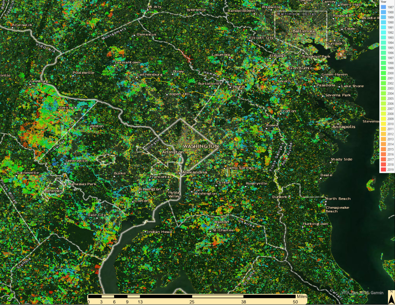
Maxar examined how urban development in the Washington, D.C., metro area has increased significantly in the last 20 years, with expansions snaking farther into Maryland and Virginia. What was once farmland is now housing developments and retail infrastructure to support population growth. Change was incremental in the 1980s and ’90s, followed by a major boom in urban development, most notably from 2005 to 2010. The most obvious change occurred in Loudon County, west of D.C.
These insights support government missions but also have tremendous commercial and public benefit. Once you understand this type of broad-scale change, high-resolution imagery can be leveraged to analyze features on the ground through a combination of automation and crowdsourcing.
Maxar’s rich foundation data also enables rapid response in a crisis. Wildfires raged in California, Oregon, Washington state and Colorado in the second half of 2020, causing hundreds of thousands of people to evacuate. The fires spread rapidly, burning nearly 7 million acres. Fast and effective detection is key to protect infrastructure and ensure community safety. Through Maxar’s partnership with the U.S. government, we were able to support 38 organizations, including the National Geospatial-Intelligence Agency, National Guard, FEMA, Army, and Air Force, which accessed more than 6 million square kilometers of imagery to support response activities.


Shortwave infrared imagery from Maxar’s WorldView-3 satellite can see through smoke to pinpoint active fire lines for first responders.
On the geospatial horizon
Looking toward the geospatial use cases of tomorrow, broader integration will deliver even better insights. As space-based sensors proliferate, the need for downstream technologies required to deliver rapid, precise and meaningful insights for decision-makers will also grow steadily. 3D registration technology is eclipsing labor- and time-intensive methods traditionally used to fuse dynamic data and georegister imagery to any spot on the globe in preparation for artificial intelligence (AI) inferencing.
AI and machine learning (ML) algorithms are growing increasingly sophisticated in the ability to detect and identify relevant objects, patterns and anomalies—pointing human analysts to the needles in the haystack of broad area surveillance.
Technology can move forward at considerable speed, but social, economic and legal systems change much more gradually. Like GPS, the impacts of geospatial democratization cannot be easily predicted until the technology is extensively developed and widely applied, but we are beginning to see glimpses of the future.
For instance, imagine how we could apply some of the aforementioned Earth Intelligence capabilities to the demographic data collected during the 2020 census. This could reveal insights on the most effective ways to encourage equitable growth by focusing investments to improve roads, bridges and other forms of critical infrastructure for the communities most in need.
The intersection of demographic and geospatial data could also help answer pressing public health and emergency response questions. Maxar recently collaborated with Johns Hopkins University to leverage census and Maxar 3D data to increase the accuracy of COVID-19 risk models. Beyond the immediate concerns of the pandemic, risk models have great utility for improving community resilience to natural disasters. For example, mortality risk is a useful tool to determine where to locate the infrastructure necessary to support innovations in natural disaster preparedness.

This Maxar Digital Surface Model reveals neighborhood-level insights on COVID-19 mortality risk in Baltimore, Maryland.
SpaceNet and the promise of AI
At Maxar, we believe these visions for the future can be realized over the next decade through an ongoing commitment to robust public-private partnerships among government, industry and academia. We are excited about the role SpaceNet can play in this journey. SpaceNet is the largest repository of freely available, high-resolution optical and radar imagery as well as training data to support research in AI and ML.
To date, SpaceNet has hosted seven challenges focused on different aspects of ML to develop solutions that automate elements of tedious geospatial tasks such as foundational mapping. Maxar, alongside our commercial and government SpaceNet partners, is excited to explore the application of AI to new sources of imagery, 3D data and other geospatial data sources.
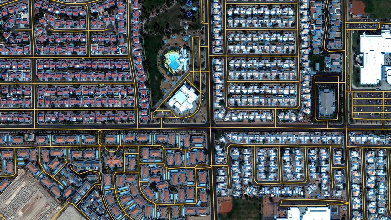
SpaceNet data outputs overlaid on Maxar imagery. SpaceNet challenges have yielded 36 algorithms available on GitHub, and the public datasets generated for the challenges have received 600 million hits and resulted in 800 terabytes of downloads.
Maxar believes AI enables huge benefits for the speed and scale at which we can serve important missions such as rapid mapping after natural disasters, maintaining updated maps globally, and identifying and understanding change.
As Maxar assumes leadership of SpaceNet, our goal is to bolster engagement with the public and open the aperture to potential new applications. Maxar invites the geospatial community to provide input on what future SpaceNet challenges should entail, what types of datasets to curate and make publicly available and ultimately how to best foster research that empowers society to take advantage of the explosion in valuable geospatial data.
The convergence of geospatial data across various fields of applications is poised to change society as much as GPS did a generation ago, but the realization of this potential will require stakeholders across the geospatial community to continue partnering and collaborating in novel ways. Maxar is proud to be a part of this innovative ecosystem and we look forward to discovering what new geospatial innovations for societal benefit are on the horizon.