The World Wide Fund for Nature (WWF) and British Antarctic Survey (BAS) are teaming up with Maxar to recruit citizen scientists to assist in conservation efforts of Atlantic and Laptev walrus populations. Participants will examine more than 544,000 Maxar satellite images of Russia, Norway, Greenland and Canada, looking for signs of walruses with Maxar’s crowdsourcing platform called GeoHIVE. The resulting survey information will help scientists identify where walruses are spending their time and how walrus habitats are changing during a five-year period in the context of a warming climate, factoring into larger conservation efforts to safeguard the future of walruses and their habitats.

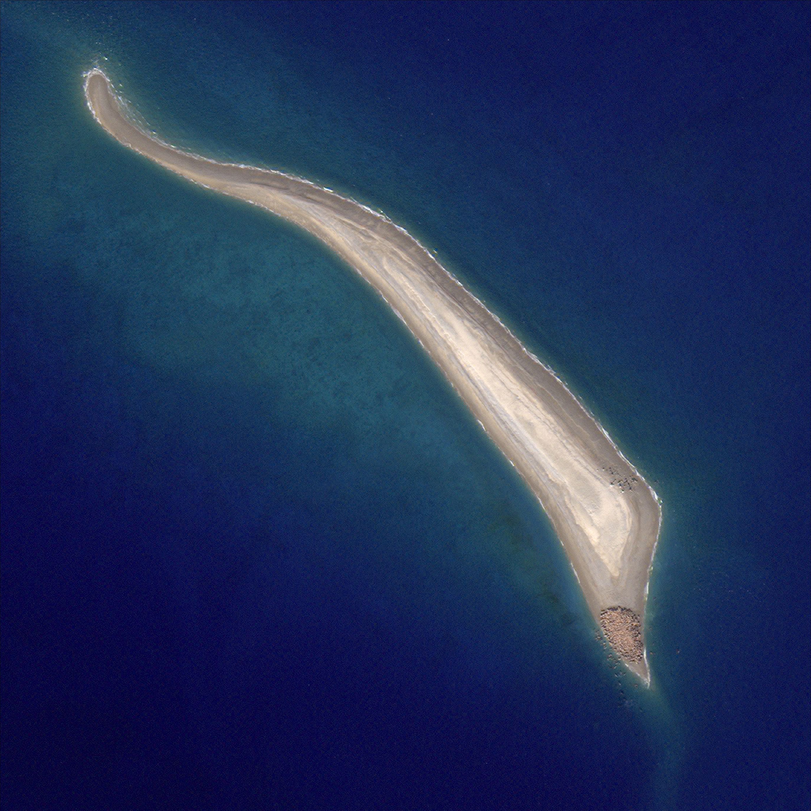
A Maxar satellite image shows a herd of walruses gathered at the end of an island.
Melting ice affects walruses
Walruses rely on sea ice as a place to rest during hunting trips and as a place to raise their young. The Atlantic and Laptev walrus populations that are being counted during this survey live in the Arctic. According to WWF, this polar region is warming almost three times faster than the global average, which is causing much of the summer sea ice to melt at a rate of 13% per decade. This rapid melt is also opening new shipping channels in the area, disturbing the walrus way of life.

Image © Richard Barrett
Resolution and collection capacity matter
This project relies on Maxar’s world-class satellite constellation to provide the foundational information for the survey. These observations from orbit do not disturb the walruses.
Maxar’s satellites collect the highest resolution satellite imagery commercially available, as sharp as 30 cm. Male Atlantic walruses reach about 2.4 m long and weigh more than 900 kg, meaning that an individual walrus would appear as about 16 pixels in a 30 cm class Maxar image. If this survey used the freely available Copernicus Sentinel-2 satellite imagery with 10 m resolution, a walrus would make up less than a pixel and be undetectable. With smaller pixels, and more pixels per image, Maxar imagery is ideal for helping citizen scientists detect and count walruses.

The slider below shows a herd of walruses on Ostrov Andreya, Russia, on August 8, 2018. The image on the left is from Sentinel-2, and the image on the right is from Maxar’s WorldView-3.
Collection capacity is also essential. Maxar’s satellites collect more than 3 million sq km of imagery per day, allowing Maxar to image many walrus habitats at once and enabling a more accurate survey.
Enabling walrus detectives
Maxar’s Geospatial Human Imagery Verification Effort—called GeoHIVE—allows users to discover and verify features of interest in Maxar’s satellite imagery to provide insight into complex questions such as “What will happen to walrus populations in a warming arctic?”
For the walrus survey, Maxar developers and geospatial analysts processed and uploaded more than 25,000 sq km of the company’s satellite imagery to the platform. Maxar software engineer Dimitrios Roussos customized the GeoHIVE platform for this project.
WWF and BAS hope that more than 500,000 citizen scientists, or “walrus detectives,” over five years will use GeoHIVE to identify which images contain walruses then count the walruses in those images. Since the survey launched in October 2021, more than 11,000 people from over 95 countries have signed up to participate, and the first year’s phase 1 image review is 57% complete.

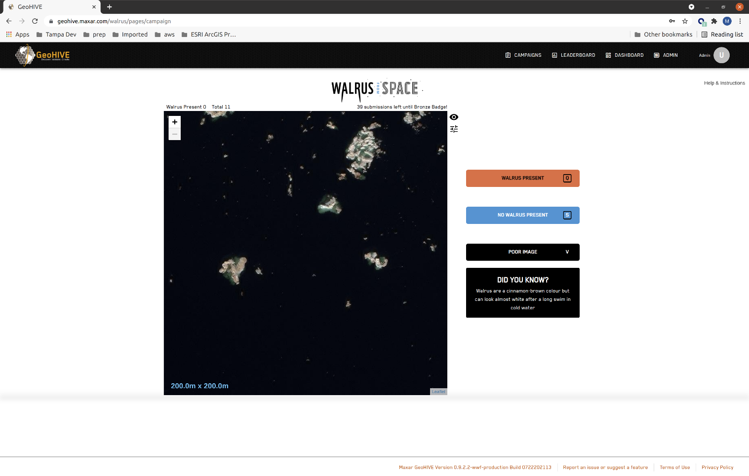
This is what participants see as they work on detecting walruses.
When the survey is complete, the results will be compared to regional data, including sea ice density, ocean temperature and ocean productivity. Together, the space-based and ground-based data will enable scientists to understand which environmental drivers are important to walrus populations to better safeguard the future of these animals.


