Editor’s note: This blog post is an update to “A New Wildlife Surveying Technique: Using Satellite Imagery and Machine Learning to Detect and Monitor Elephants,” published in March 2019.
The population of African elephants (Loxodonta africana) has plummeted over the last century due to poaching, retaliatory killing for crop raiding and habitat fragmentation. To protect these elephants requires knowing where they are and how many exist–accurate monitoring is vital. Existing methods are prone to error. Inaccurate counts lead to misallocation of scarce conservation resources and misunderstanding population trends.
Currently the most common survey technique for elephant populations in savannah environments is aerial counts from manned aircraft. However, observers on aerial surveys can get exhausted, be hindered by poor visibility and otherwise succumb to bias. Additionally, aerial surveys can be costly and logistically challenging.
As researchers from the Wildlife Conservation Research Unit, University of Oxford and Machine Learning Research Group, University of Bath we used Maxar’s WorldView-3 satellite imagery and deep learning (TensorFlow API, Google Brain) to detect elephants from space with comparable accuracy to human detection capabilities. This method also solves various existing challenges.

Maxar satellites (WorldView-3 shown above) can collect upward of 5,000 km² imagery in one pass over a matter of minutes, eliminating the risk of double counting and allowing for repeat surveys at short intervals. This unobtrusive technique requires no ground presence so the animals are not disturbed, and human safety is not put at risk during data collection. Previously inaccessible areas become accessible, and cross-border areas–often crucial to conservation planning–can be surveyed without the time-consuming requirement of obtaining terrestrial permits.
We leveraged deep learning to process enormous amounts of WorldView-3 data in a matter of hours, instead of the months it would have taken us to sort it by hand. The deep learning algorithms produce consistent results that are less prone to error, false negatives and false positives. They also can be rectified by systematically improving models–the same cannot be said for humans.
To develop this method, we created a customized training dataset of more than 1,000 elephants in South Africa and fed it into a Convolutional Neural Network (CNN). The results were then compared to human performance. In a March 2019 blog post, we described how we created the training dataset and trained the CNN.
We’re now proud to share the results of our work. The CNN can detect elephants in satellite imagery with accuracy as high as human detection capabilities. The results (known as the F2 score) of the CNN models was 0.78 in heterogeneous areas and 0.73 in homogenous areas, compared with, an averaged human detection capability F2 score of 0.77 in heterogeneous areas and 0.80 in homogenous areas. The model could even detect elephants in places far from the training data site showing the generalizability of the model. Having trained the machine only on adult elephants, it was then able to identify calves.
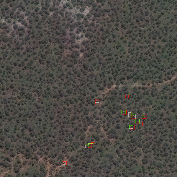
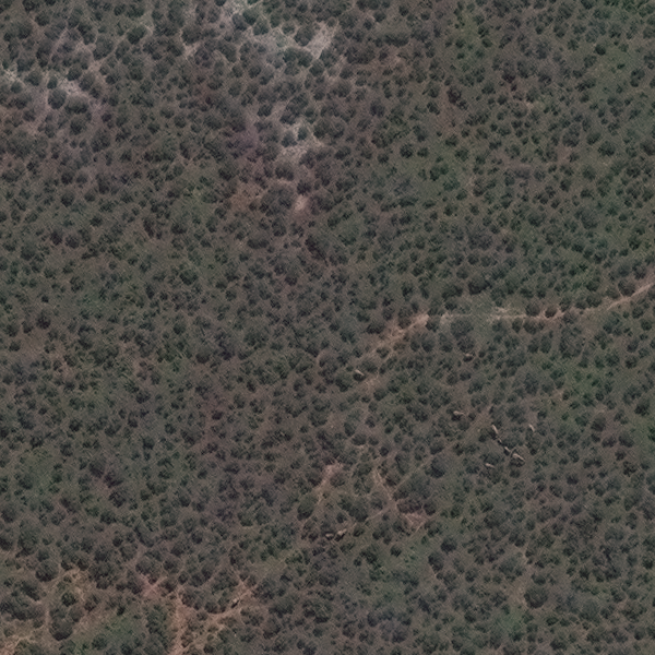
Use the slider above to see if you can spot all of elephants in the image on the left then compare your results to what the CNN found, highlighted in red and green boxes.
We believe that this demonstrates the power of modern technology to serve conservation purposes: satellite remote sensing and deep learning technologies offer the promise of a safer life to these majestic mammals. Conservation technologies open a new world of possibilities, to be embraced with the urgency necessitated by the sixth mass extinction and the global plight of biodiversity.

Read our full scientific publication in Remote Sensing in Ecology and Conservation.