Maxar Technologies announced today that it has achieved the new Amazon Web Services (AWS) Public Safety and Disaster Response Competency status, which was unveiled at AWS re:Invent 2019. This designation recognizes that Maxar provides proven data, technology and expertise for helping customers leverage the power of AWS to protect the public, and prepare for, respond to and recover from natural or man-made emergencies and disasters.
To earn the new AWS Public Safety and Disaster Response Competency, Maxar demonstrated its commitment to supporting humanitarian organizations with our Earth intelligence and space-based technology solutions during disaster situations by:
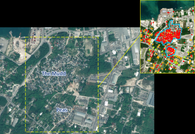
- Providing high-resolution imagery and geospatial analytics that offer critical, timely insights to first responders. As part of Maxar’s Open Data Program, the company publicly releases pre- and post-event data of the affected areas as it becomes available.
- Additionally, Maxar’s FirstLook service is an online subscription service for emergency management that provides fast, web-based access to pre- and post-event satellite imagery of disasters around the world. This data is leveraged for determining accessible transportation routes, creating damage assessment reports via Maxar’s GeoHIVE platformand sending on-the-ground response teams to the hardest hit areas.
- Maxar stores its 100-petabyte optical satellite imagery library in Amazon Glacier and Amazon Simple Storage Service (Amazon S3), which allows the company to quickly deliver imagery and insights to those that need it most.
AWS is enabling scalable, flexible and cost-effective solutions from start-ups to global enterprises. To support the seamless integration and deployment of these solutions, AWS established the AWS Competency Program to help customers identify APN Consulting and Technology Partners with deep industry experience and expertise.
Achieving the AWS Public Safety and Disaster Response Competency differentiates Maxar as an AWS Partner Network (APN) member that provides specialized demonstrated technical proficiency and proven customer success with implementing workloads focused on disaster & public safety data and analytics tools. To receive the designation, APN Partners must possess deep AWS expertise and deliver solutions seamlessly on AWS.