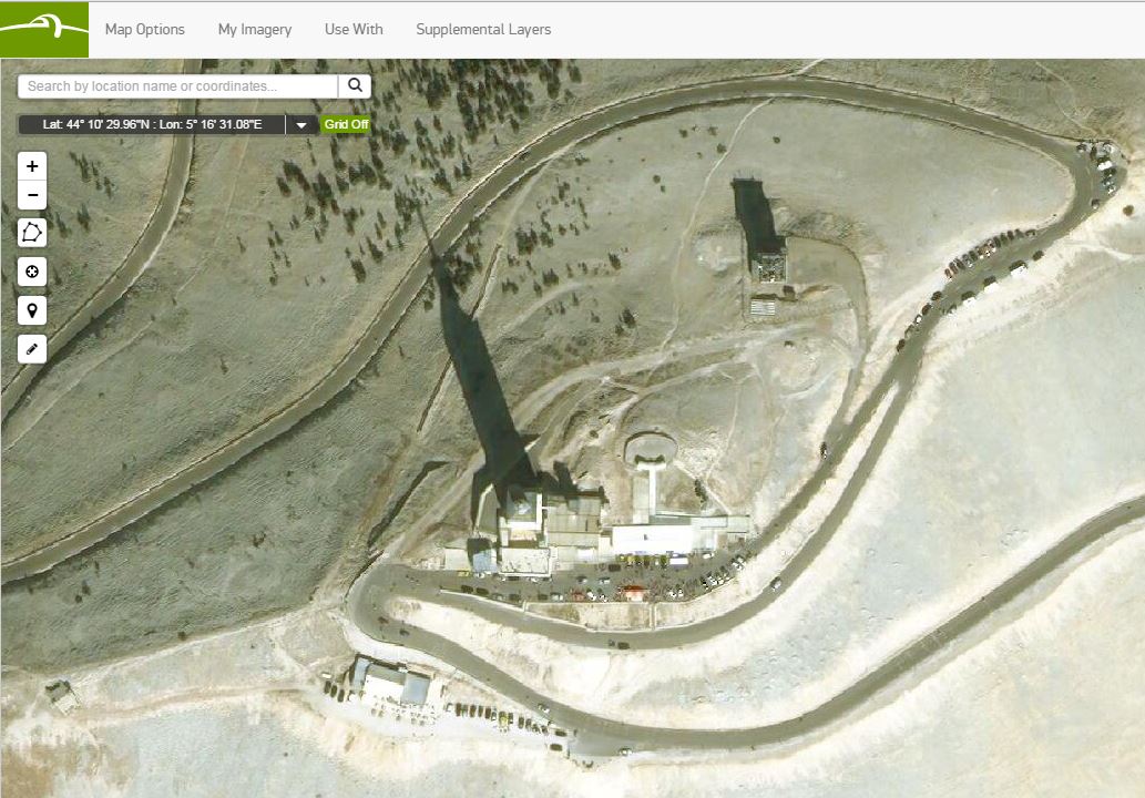
 The summit of Mont Ventoux seen in Basemap +Vivid, where riders in the Tour de France will face one of their most difficult climbs next month.
It’s still TBD if either the author or his daughter will make it on their bikes one day.[/caption] We’re proud to work with Esri on this ambitious project to put very-high-resolution satellite imagery into the hands of the most advanced GIS users. We know that Esri has the largest, most sophisticated geo-user-base on the planet. They know that DigitalGlobe is the only company with off-planet satellites that can capture imagery all over the globe at 30 and 50 centimeter resolution. Both companies recognized the potential good that would come from giving millions of users access to billions of pixels of imagery, all ready to use in ArcGIS. By incorporating the Basemap +Vivid country-wide coverage and the rapidly updated Basemap +Metro imagery in urban areas, World Imagery Map users will have mosaics on which to build roads, buildings, water features, and so much else of the data that drives GIS. Our Basemap +Vivid imagery will be available to World Imagery map users at 1.2-meter resolution. While this might be enough for many users, those that need to see more detail can contact DigitalGlobe to upgrade to the full 50 cm resolution +Vivid imagery. That’s an extra two zoom clicks in most web mapping programs, so you can see a lot more detail on the ground. Esri will have 750 metros from our program, and we have over one thousand more available online in both 50 and 30 centimeter resolution. Check this interactive map to see if your city is one of the more than 2,000 population centers in our program. Just like chocolate and peanut butter, maps and imagery are better together. We can’t wait to see what our users will build when we combine these premium image layers with the world’s most used GIS software. And I can’t wait to see my little girl riding her bike, of course with brakes and a helmet!