One year ago, WorldView-3 successfully launched into orbit, bolstering Maxar’s world-leading constellation with the first super-spectral, high-resolution commercial satellite. WorldView-3’s unmatched capabilities have expanded the bounds of what is possible in remote sensing. With 30 cm panchromatic resolution that collects five times more data than 70 cm imagery, Short-Wave Infrared bands (SWIR) that allow for accurate imaging through haze, fog, dust, smoke and other air-born particles; and eight multi-spectral bands, WorldView-3 has helped our customers to see the earth clearly and in new ways. During her first year in orbit, WorldView-3 enabled us to contribute to disaster and humanitarian relief efforts, push the boundaries of technology and support commercial applications in ways never seen before. Here are a few of our favorite highlights.
Contributions to disaster and humanitarian efforts
- In response to the devastating 7.8-magnitude earthquake that struck central Nepal on April 25, WorldView-3 did what others could not, offering images sooner than any of our competitors due to her ability to maneuver and collect imagery despite poor weather conditions. The multi-spectral imagery captured by WorldView-3 was made freely available online along with pre-event imagery to aid in the global crisis response.
- We are collaborating with the World Resources Institute (WRI) to map burn scars from the rash of fires that began May 29 in Indonesia’s Tesso Nilo National Park. WorldView-3’s 30 cm resolution and SWIR technology have enabled WRI to more accurately determine the extent of land affected by forest and bush fires as well as the degree of illegal encroachment of the protected park.

Pushing the boundaries of technology
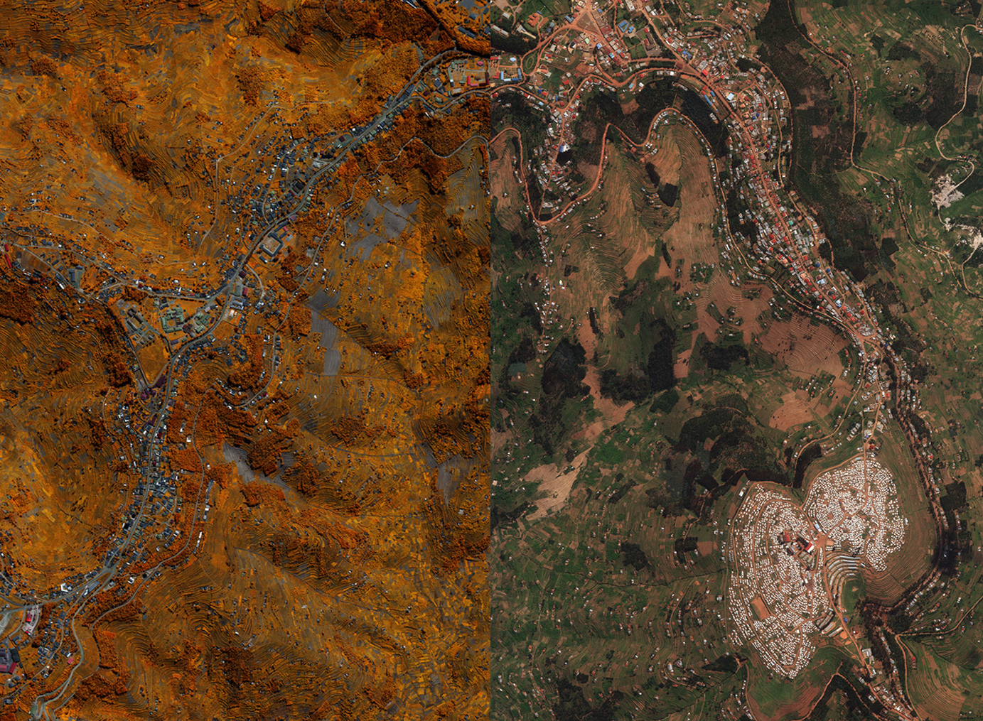
- WorldView-3’s CAVIS sensor offers the capability to improve imagery by compensating for conditions – clouds, aerosol, vapor, ice and snow. When CAVIS data is collected, it can boost the accuracy of WorldView-3’s surface reflectance, improving image quality with better colors and more consistency.
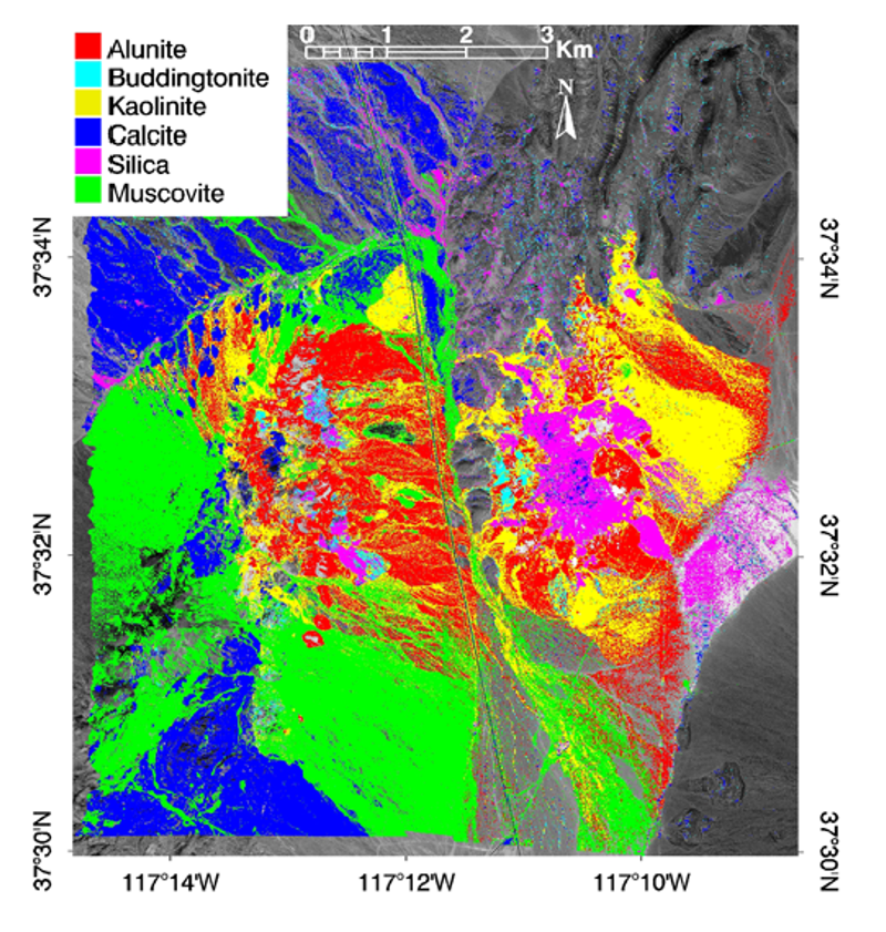
- A research paper published in the Journal of Applied Remote Sensing this May confirmed WorldView-3’s eight SWIR bands provide extensive new mineral mapping capabilities not available from other spaceborne multispectral systems. With the help of her SWIR sensor, WorldView-3 offers more accurate information for geology, mining, agriculture and many other applications.
Opening new commercial opportunities
- Feeding subscription-based solutions like GBDX—our Geospatial Big Data platform—with higher quality information from WorldView-3 is leading to new innovative applications for commercial customers. New uses include monitoring pipelines, big data commodity forecasting and automated feature extraction.
- Using WorldView-3’s various spectral bands and 30 cm imagery, civil governments are able to collect information to better understand crop inventory and assess crop health in a given region. Information on crop inventory and health can help government officials with decisions on policy and food security.
It’s been an exciting and productive first year for WorldView-3. To-date, WorldView-3 has collected over 180 million square kilometers of imagery in her first year, equal to 1.2 of the earth’s land mass.